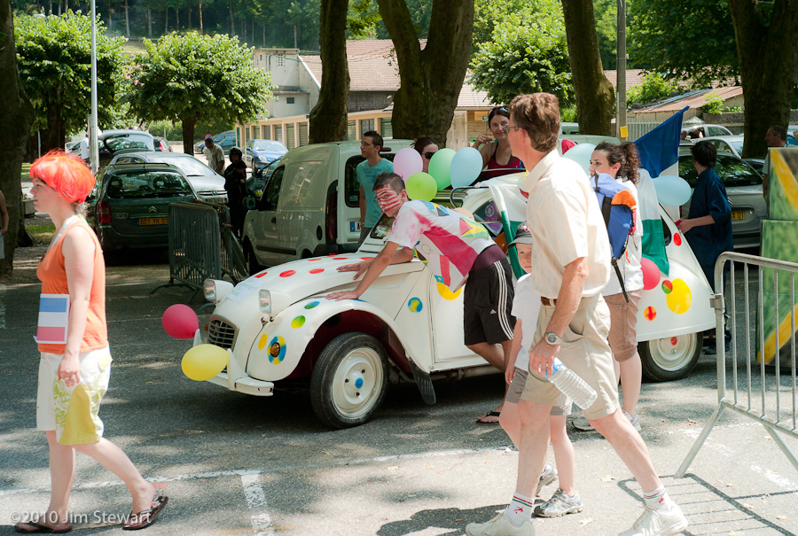
Holidays
we're back
04/07/11 23:50
from our first, long-delayed, much prevaricated
trip to the Eilean Siar, the Western isles.
Ten days across Lochaber and Skye to Harris, Lewis and North Uist. With a very brief foraging trip to Benbecula.
And now we’re back in the metropolitan hubbub that is Fort W...
... and it’s another regatta night at the yacht club. So it’s good to see the Lochaber light again, and yachts on the water below the kitchen window.
Backfill of blog with tales and pics from the Isles to follow in the next few days....
For tonight, no more. This being the tenth anniversary of Jim’s mother’s death.
Comments
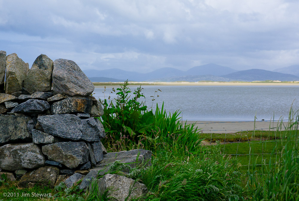
a Harris journal : day 7 : dreaming of St. Kilda
01/07/11 23:36
when the skies cleared and the horizon came plain to view, Jim was surprised to discover
that the abandoned island of St Kilda was visible from the windows of our Hebri-gîte in Ardhasaig.
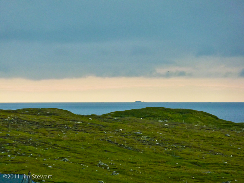
Sadly not true, though. St Kilda is visible from North Uist, but not from Ardhasaig. Turns out that’s just some rock… shame!
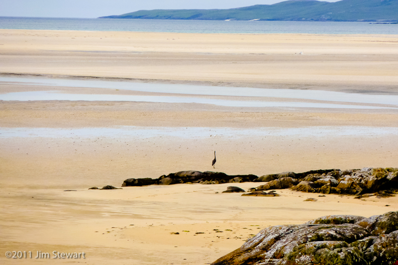
So it’s back to Luskentyre beach, to see it one last time, and while the sun shines and a heron is patrolling the strand
a Harris journal : day 6 : history day
30/06/11 21:37
back over the col to Lewis
and back in time, too, to visit some of the island’s heritage sites. (Click on pictures to enlarge)
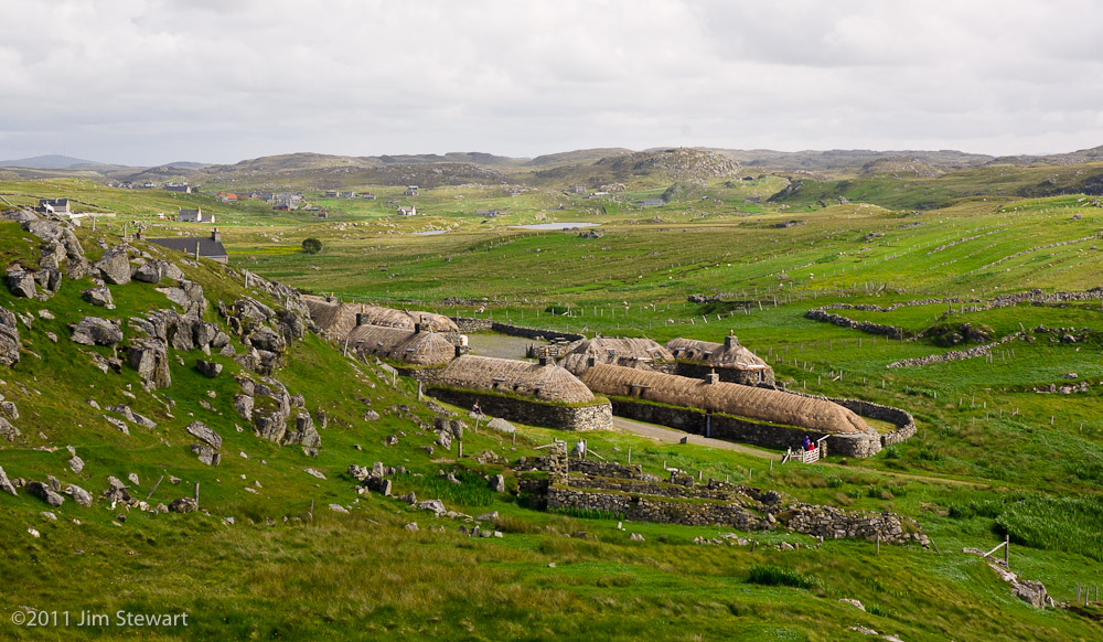
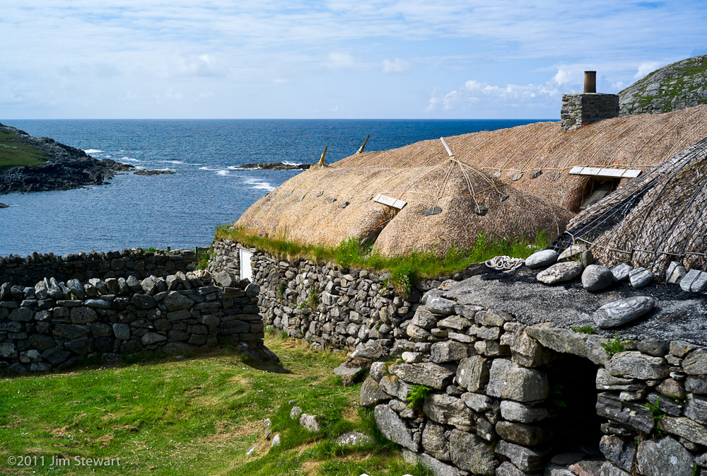
The last inhabitants of Gearrannan blackhouse village left in the 1970’s.

Until recently it was, in part, a youth hostel. Today, some of the buildings are available as holiday rental properties.
But it does survive as a remarkable example of a recently-vanished way of life, and its setting is both beautiful and also rather exposed.
On the Atlantic coast of Lewis, this would have been a wild place on a stormy day.
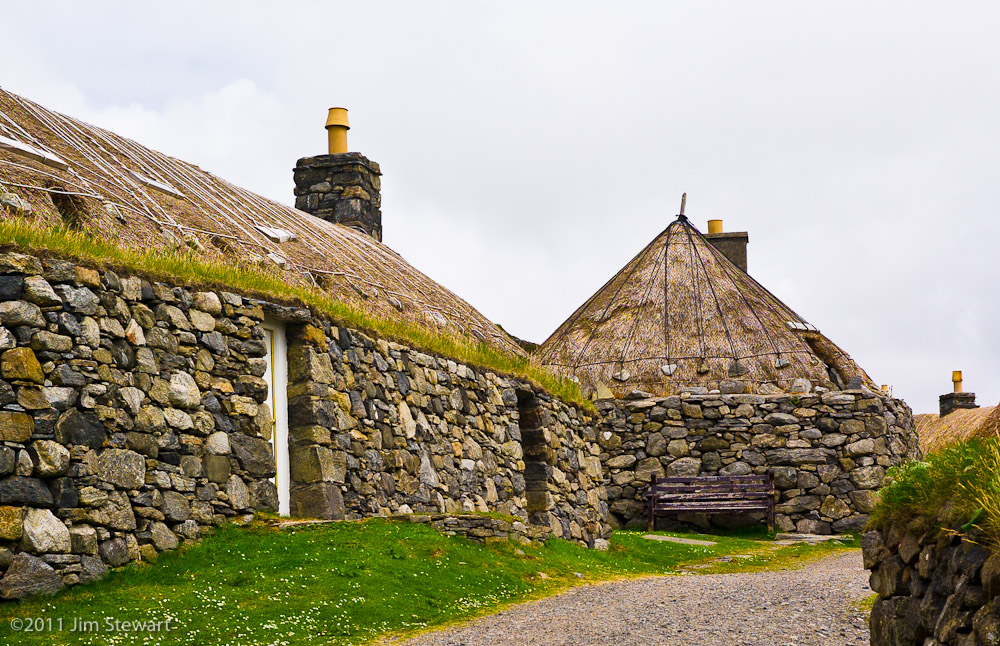
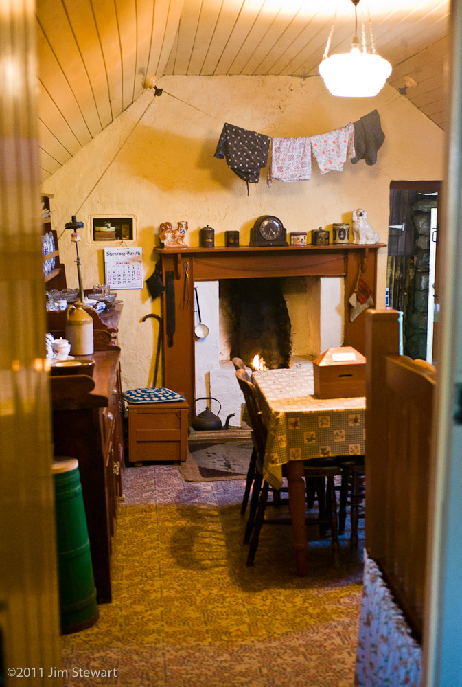
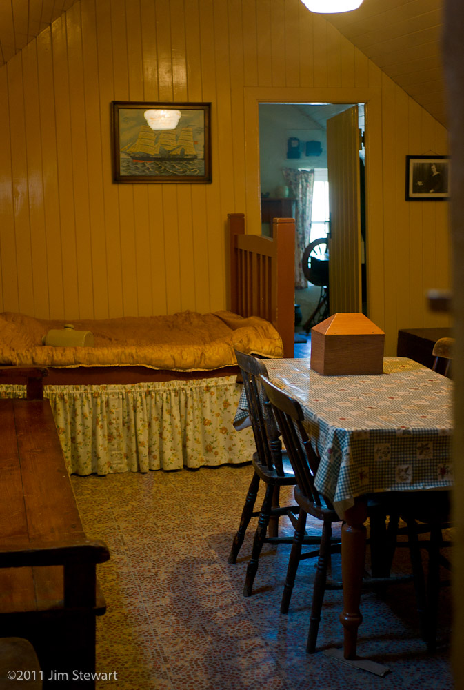
Inside, however, it’s a bit cosier than the style of blockhouse living we’d seen in the Highland Village at Newtonmore (see the sequence of pictures here)
By the 1970’s, blackhouse living had come on a bit: in the rooms lined wooden walls where in earlier times had just been rubble and turf; heating from a fire in a grate, with a fireplace and enclosed chimney, replacing the open peat fire smoking away in the middle of the floor which gave the blackhouses their name


and the tweed loom had replacing the cattle in the back room.
From Gearrannan we moved on down the coast of Loch Rog an Ear to Tolastadh a’Chaolais
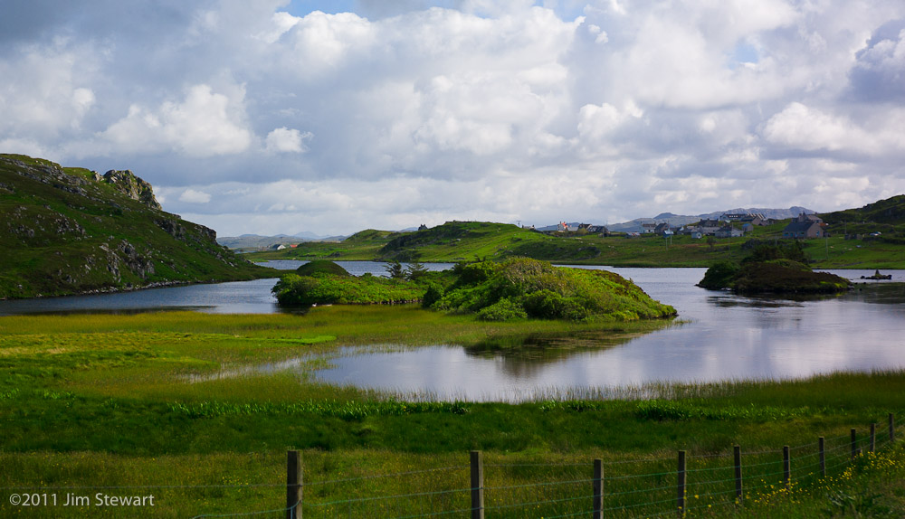
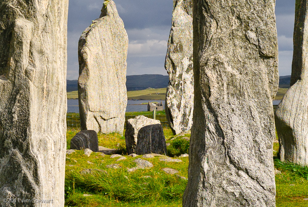
and thence to Calanais, or Callanish…
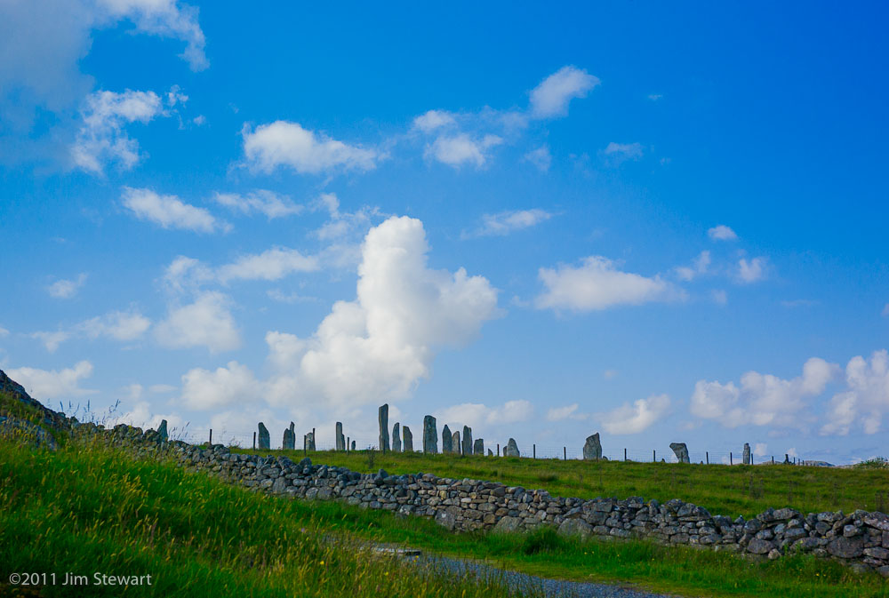
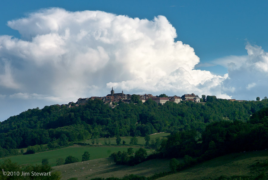
As previously remarked, the Hebridean landscape differs from that of west Highland Scotland in the omnipresence of its human habitation: and that’s as true of the very oldest human corners as anywhere else. Unlike the similarly ancient Stonehenge, Callanish is today still directly adjacent to modern houses...

… as much a part of the village today as it must have been throughout the last 3000 years

From Calanais, it’s time to head back to Harris, but the stunning light developing means there have to be a few more photo-stops before we leave Lewis for the last time (this trip, anyway…)
So here’s four pictures to mark our farewell to Lewis for 2011…
a Harris journal : day 5 : to Lewis
29/06/11 22:56
and in Stornaway, the economy seems to have run aground
 (ho, ho)
though elsewhere in Lewis the island light is as pure and as stunning as ever
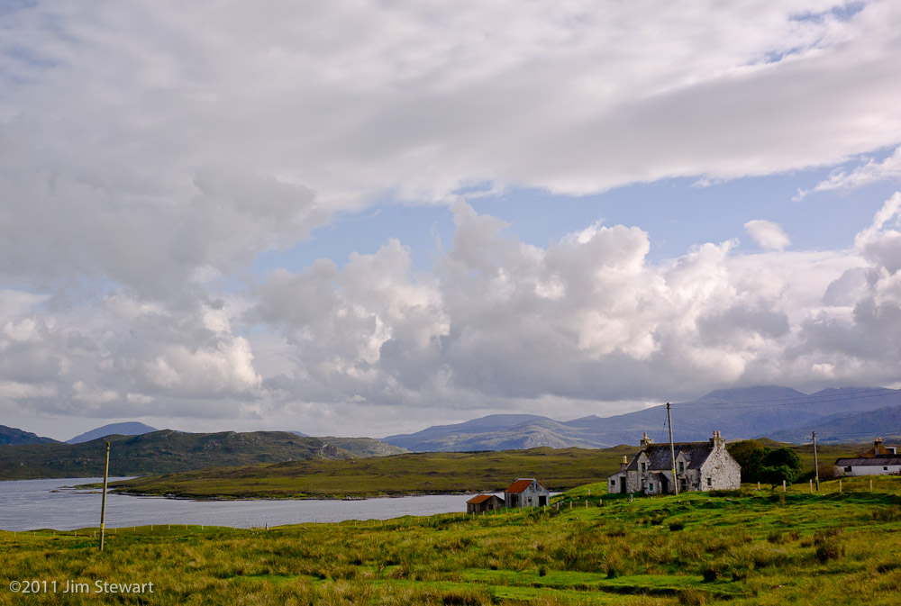
these abandoned homes sit above Loch Seaforth (Shiophoirt) alongside the main Harris <-> Lewis road
and there’s rain in the air once again as we climb back over the pass into Harris
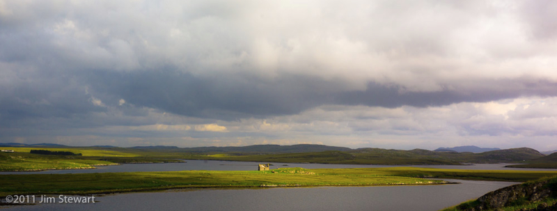
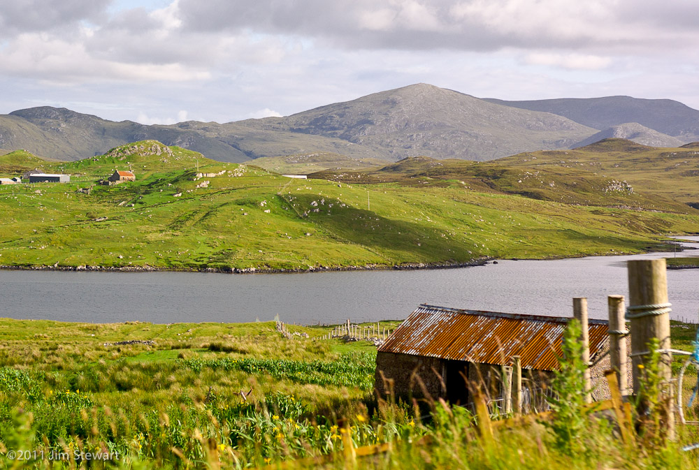
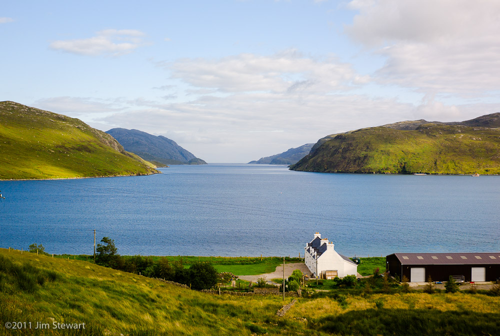
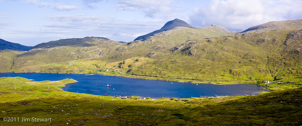
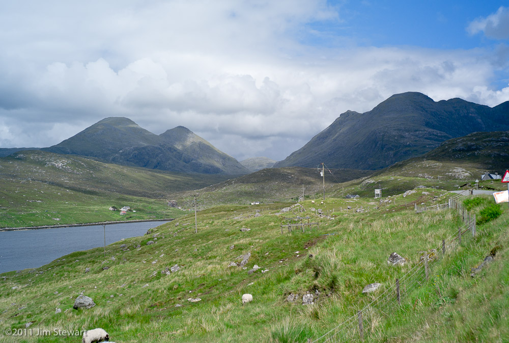
a Harris Journal : day 4 : west to east
28/06/11 22:18
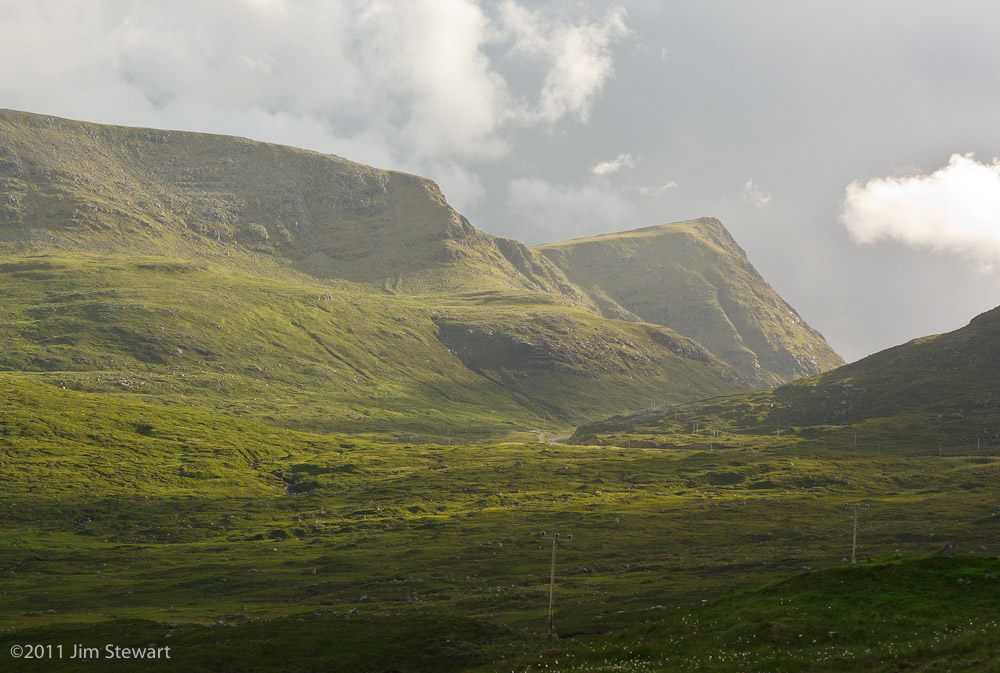
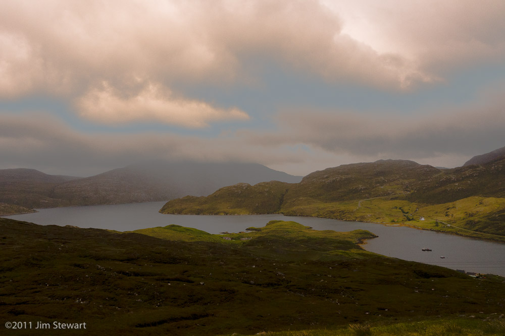
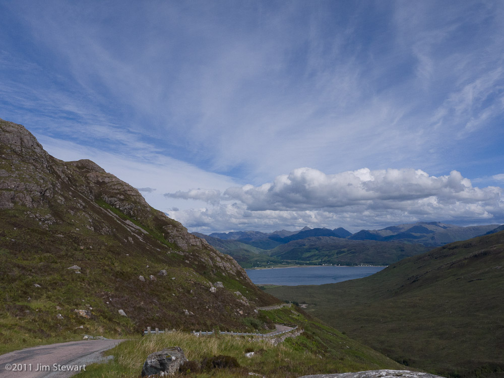
a fine morning in Ardhasaig, with the hilltops clearly visible for once
So off we head westwards, past the eerie remains of the old Norwegian whaling station

to the famous sandy beach to the west at Hushinish

Sometimes on days like this the chromatics of sea and sand seem more Caribbean than British
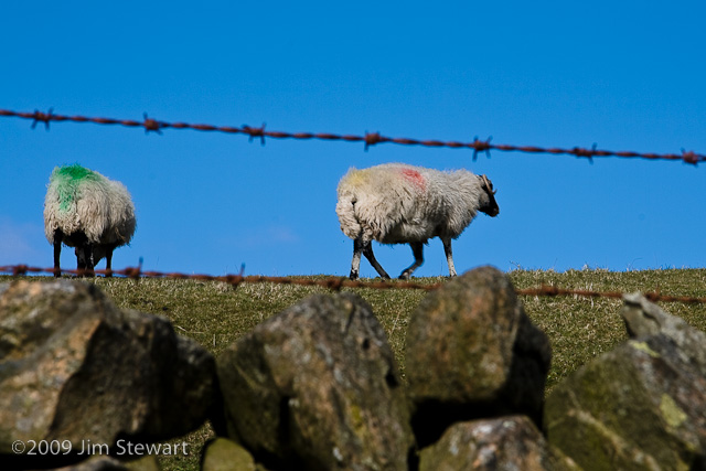
As we head back towards Tarbert, though, the landscape is unmistakably Scottish
as are the fauna.
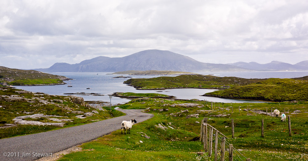
Having done the west route, we continued on through Tarbert and on over the bridge that links Harris and the isle of Scalpay off its eastern coast.
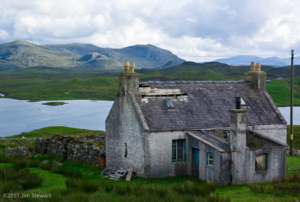
A major part of the character of the islands comes from the fact that, in such far flung places, broken down and unwanted properties of all kinds remain to rust and rot, until gradually over time they will simply be absorbed by the land or the sea.

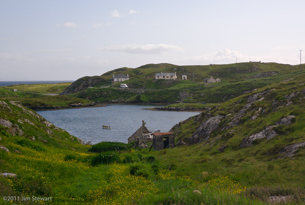
So this is not a landscape wild or undisturbed. This landscape bears the marks of human presence and history at every turn. And for the most part it’s the history of ordinary island folk, whose relics linger after them and bear witness to their lives and struggles
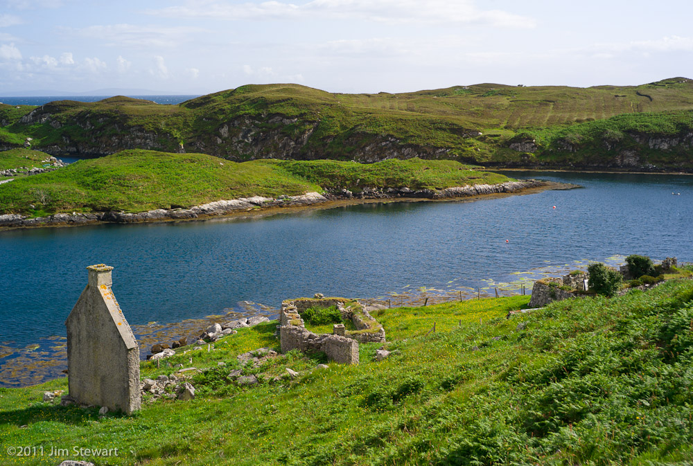
Who lived here? And who allowed a habitation in such a beautiful spot to crumble and collapse?
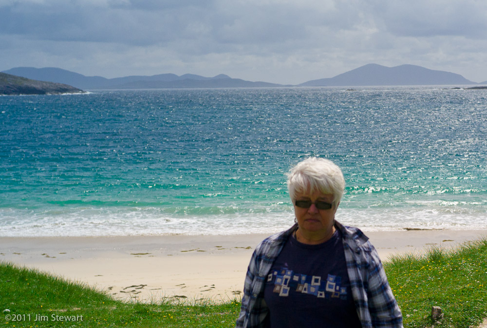
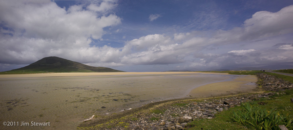
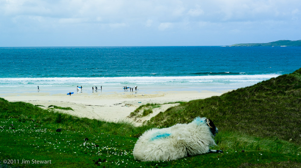
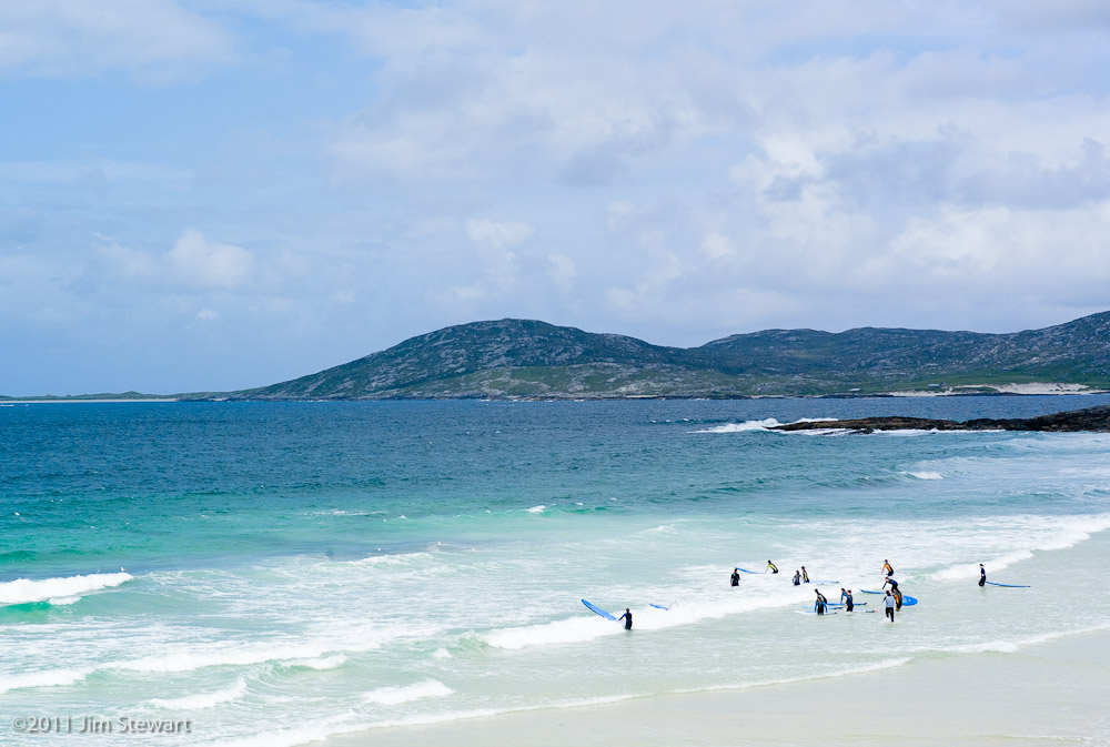
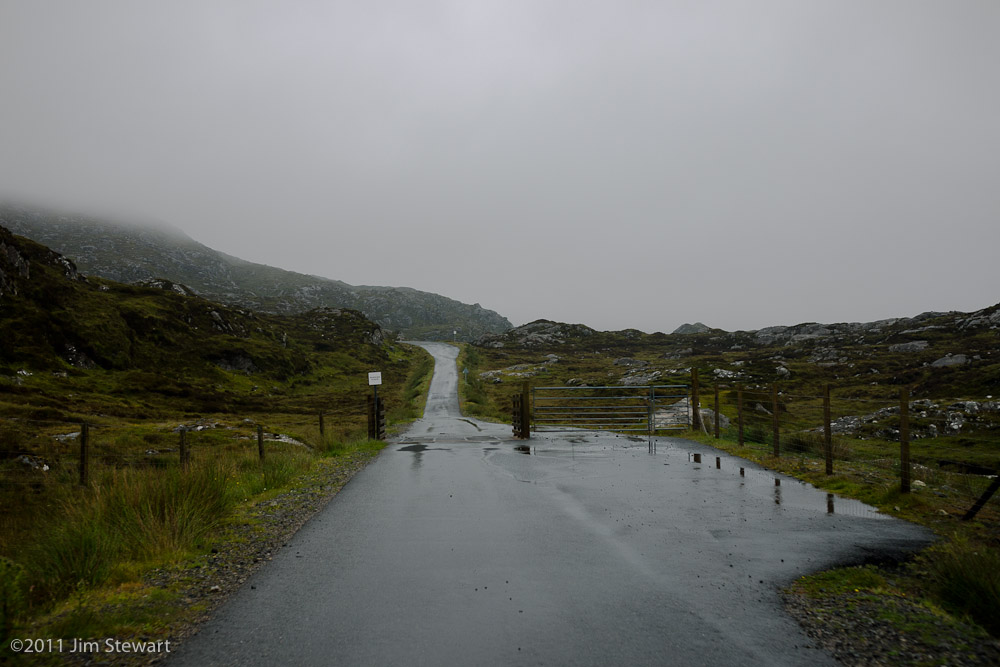
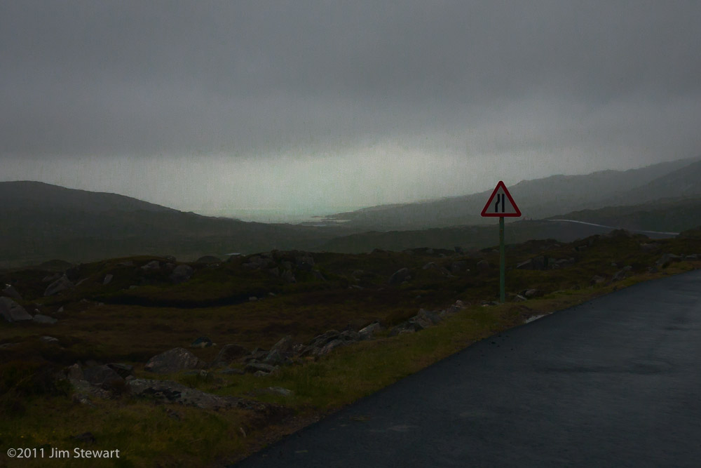
a Harris journal : day 3 : South Harris
27/06/11 23:03
a day-trip around the southern part of Harris...
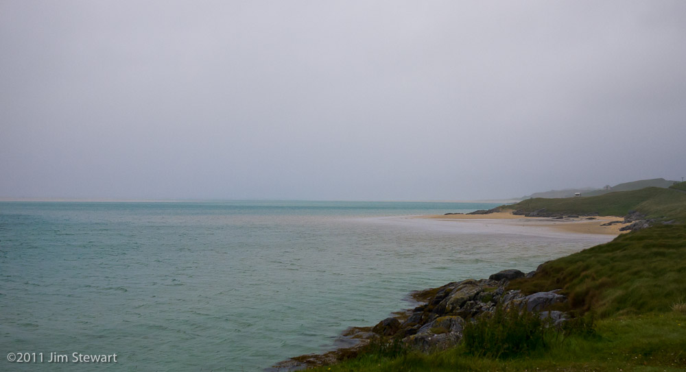
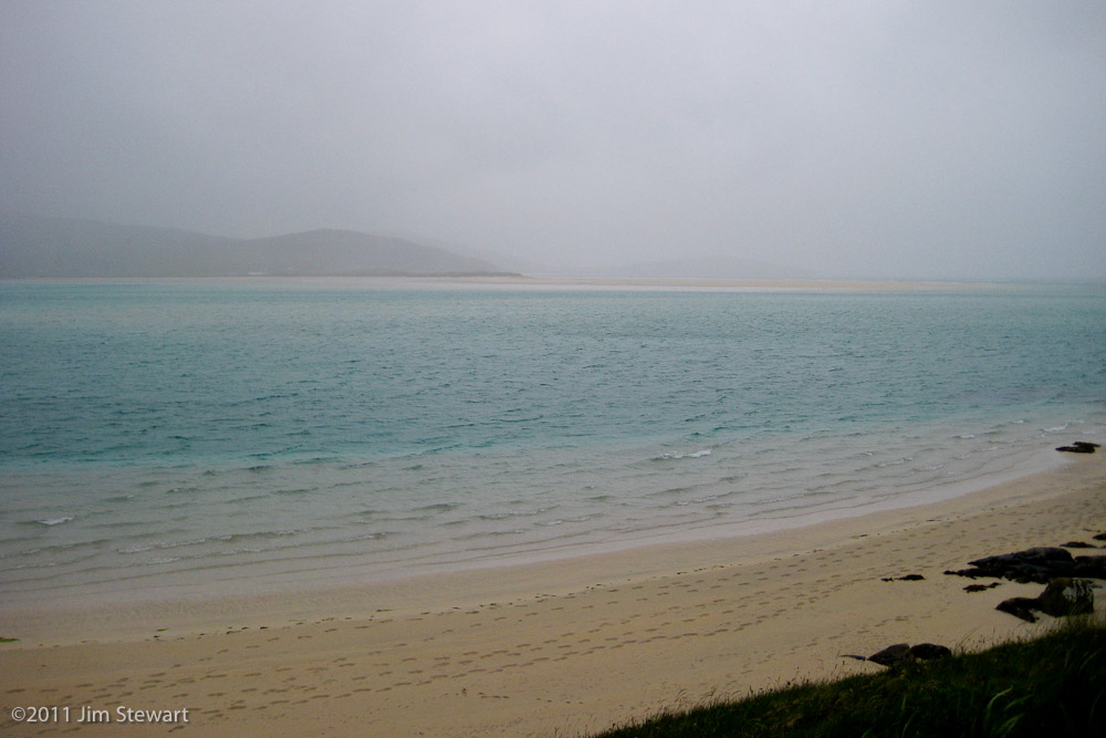
… an area renowned for its vast sandy beaches
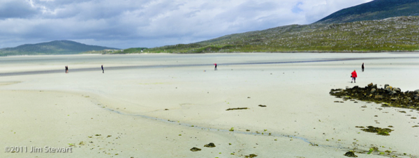
By reputation these expanses of sand are deserted. But it seems nobody told these surfers
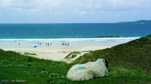
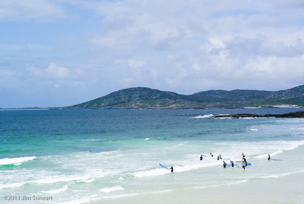
… an area renowned for its vast sandy beaches

By reputation these expanses of sand are deserted. But it seems nobody told these surfers

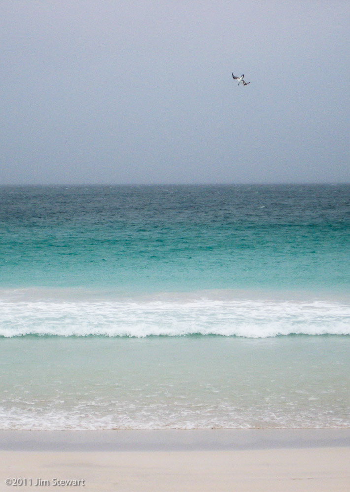
a Harris journal : day 2 : miracle at Luskentyre
26/06/11 23:45
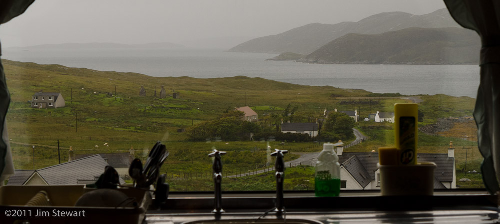
our first full day on Harris is a Sunday. And as wet a Sunday as you could ever hope for
Best seen through the kitchen window, maybe
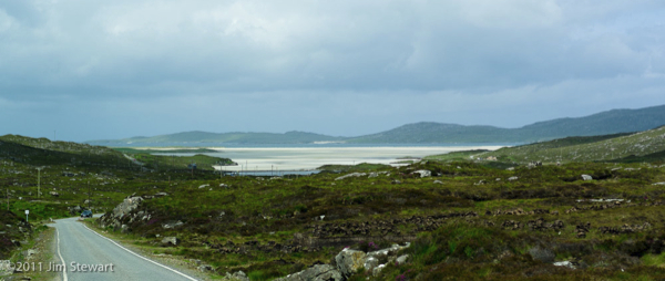
So it’s quite late in the day that we decide to get out, and head for the famous beach at Luskentyre
Along the way, South Harris shows its lunar appeal
and it seems the darkest time is just before the light as we descend towards the sea, and the beach at Luskentyre appears in the distance, glowing through the gloom
The light here is quite extraordinary. The sea glows turquoise, and through it the sand seems illuminated by a light whose source is genuinely mysterious
If the sea is blue because it reflects the colour of the sky, then when is the sea here, today, this luminous green, when the sky is grey, going on black?
And there’s more. We brave the rain to go watch gannets playing in the surf. Really quite unusual to get so close to these creatures
 ,,,,,,,,,,
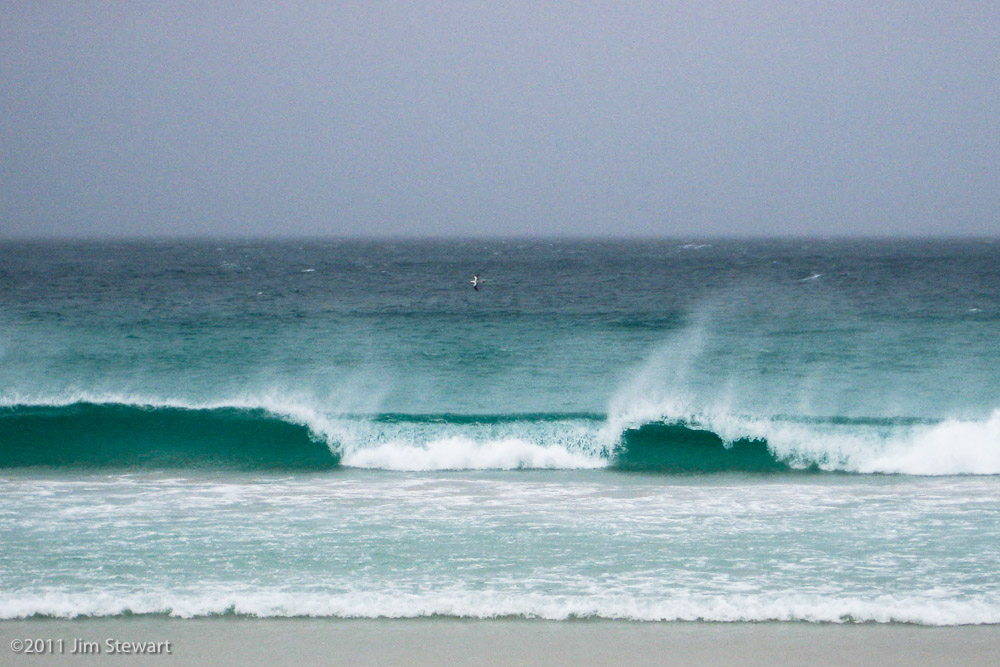
We get thoroughly drenched walking half a mile from the car to the beach, but the rain stops and the wind dries us out again on the walk back!
Then it’s back to Ardhasaig, wher the evening light suggests we may have a better day coming tomorrow
a Harris journal : day 1 : arrival
25/06/11 23:30
as we left Uig on Skye the rain seemed to sweep in and swallow it up behind us
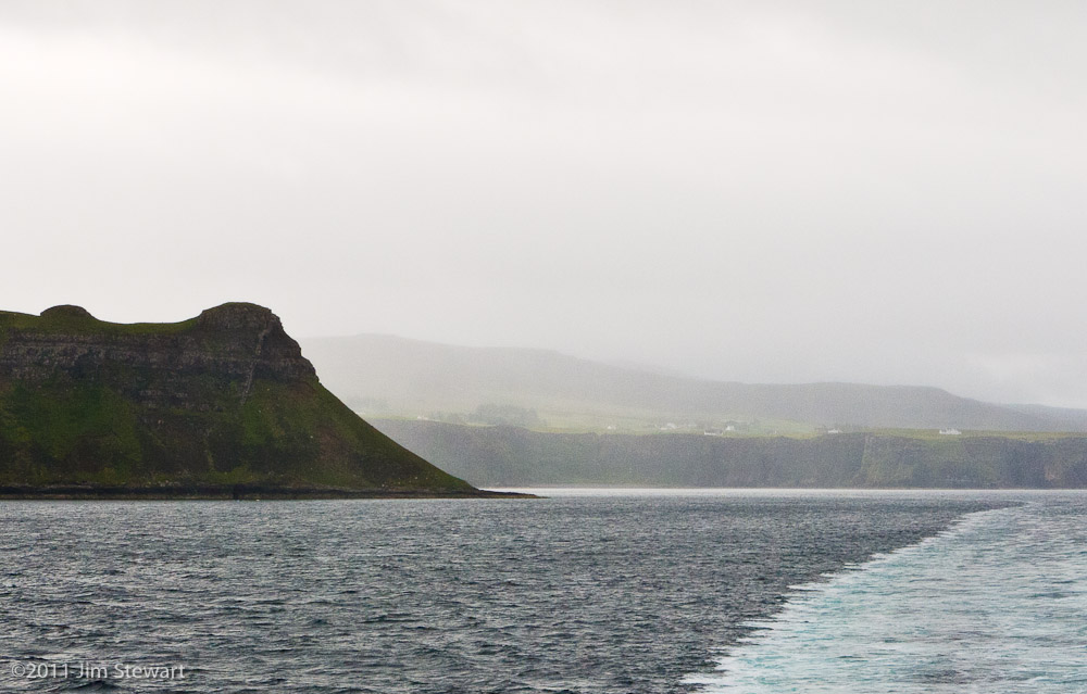
When we reached Tarbert on Harris, the rain was horizontal

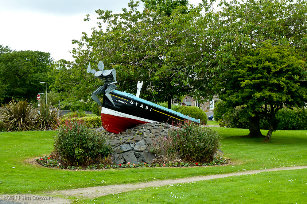
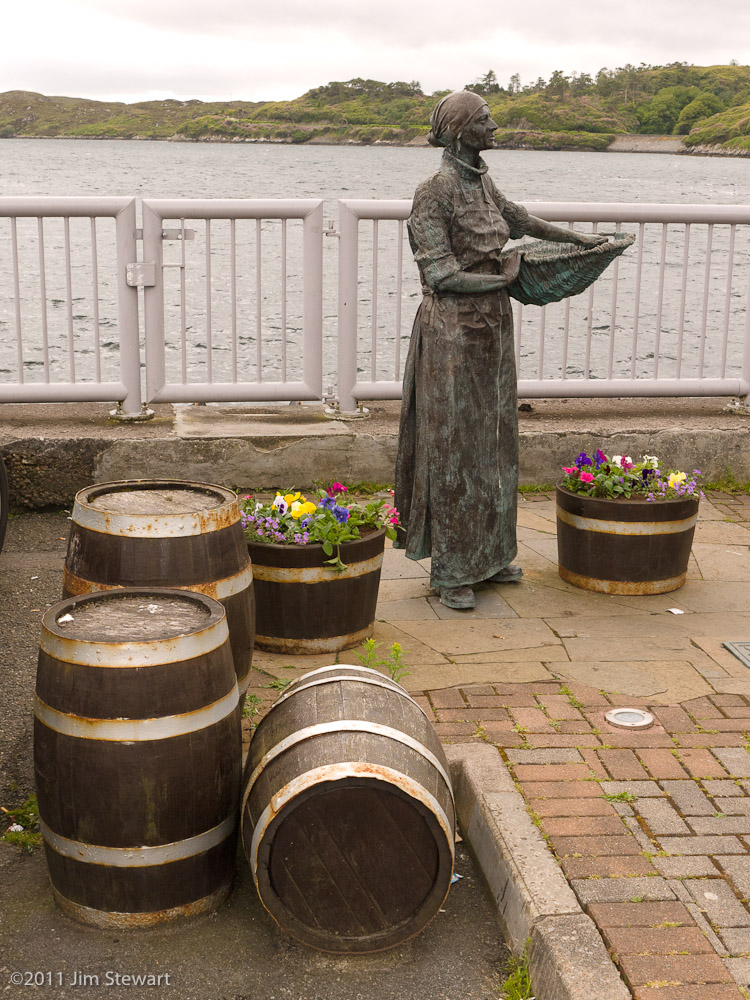
No access to our cottage til later in the day, so off we head to Stornoway, where ancient fishing boats come to linger in reminiscence
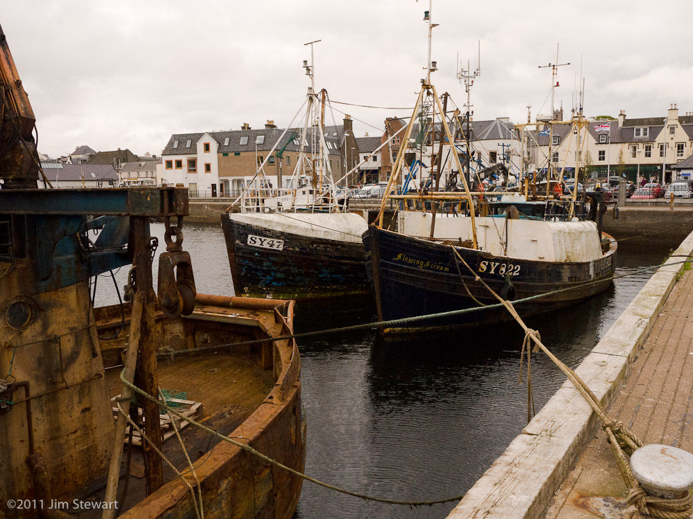
of herring girls long-gone
.....................................................
Then it’s back down to Harris, and there’s now some hope of sunshine in the afternoon air
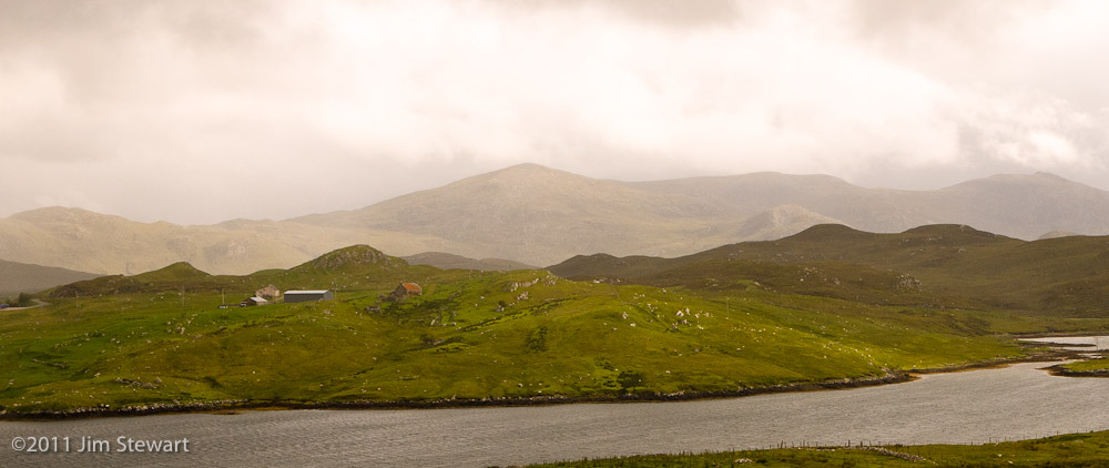
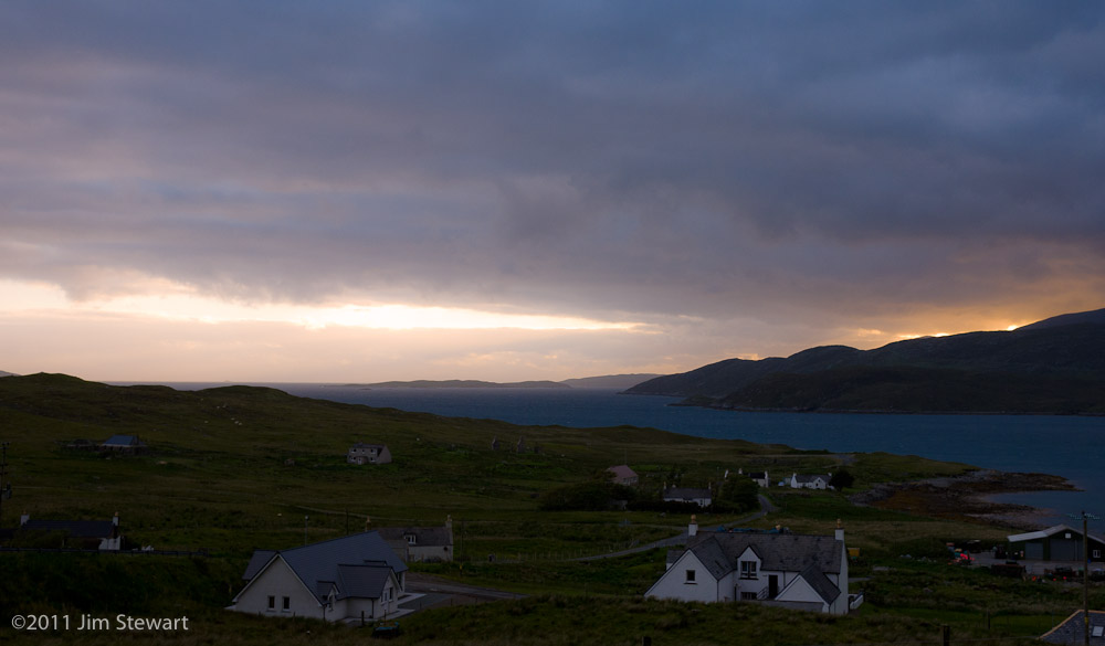
The boundary between Harris and Lewis seems as much a matter of geology as politics, as we cross it at the bottom of the pass over the North Harris mountains which lie between Ardhasaig and Loch Seaforth.
Ardhasaig will be our base for the next week. We picked it for its apparent potential for stunning views of mountains, loch and ocean. For now, it’s enough to settle in as gloomy turns to gentle island gloaming
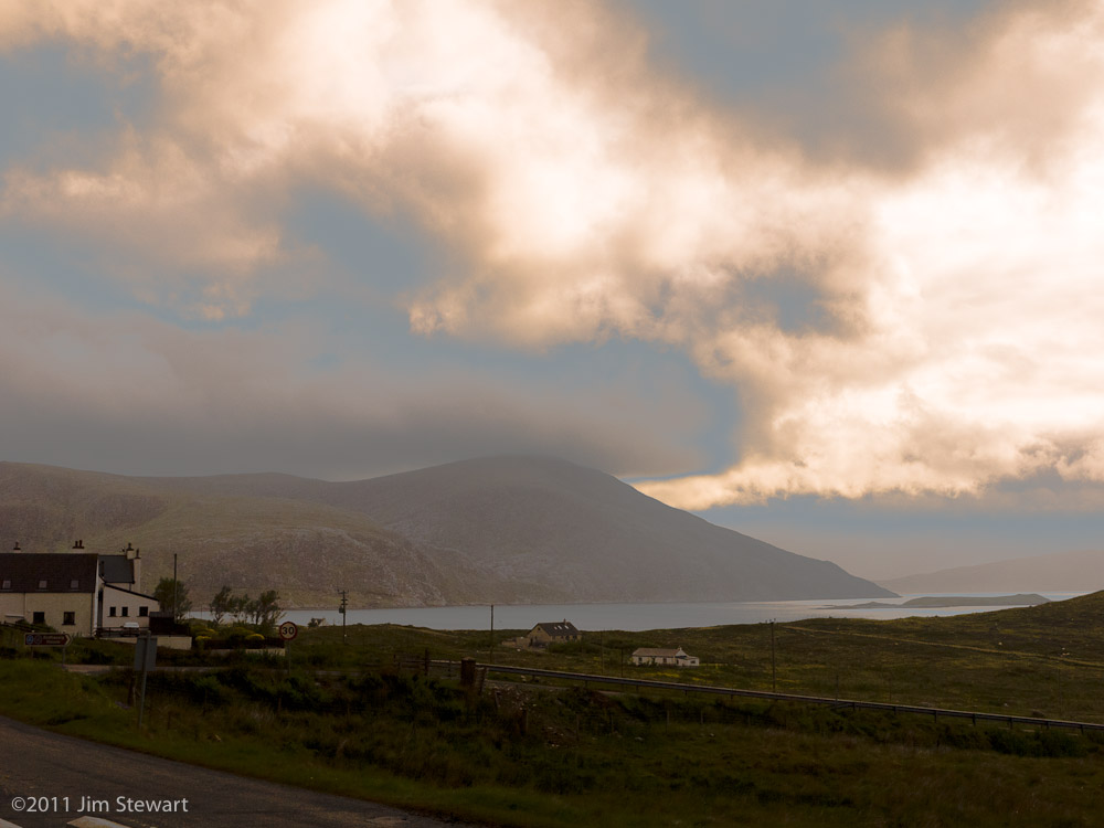
Some light, eh!!!
a Hebridean adventure
24/06/11 23:58
starts here
Down and out of Fort William, in the Cooper D Convertible
and off to Skye. This time via the Glenelg to Kylerhea Community Ferry. The road to Glenelg gives a new perspective on the hills of Kintail, as we climb up above Loch Duich
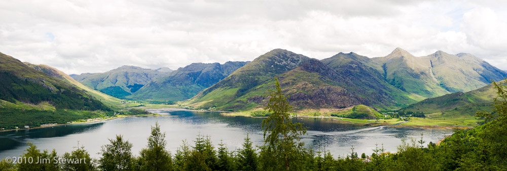
and as we look back from Skye
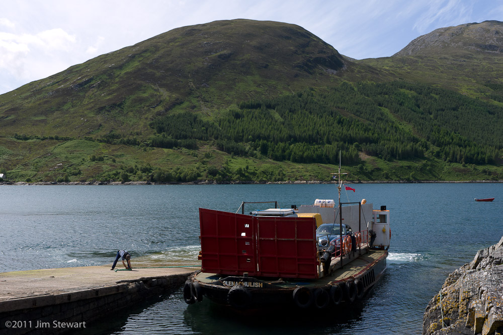
The Ferry boat itself reveals its origin as the wee vessel that used to ply the waters of Loch Leven, twixt N. and S. Ballachulish, before the Ballachulish Bridge was built about 40 years ago now
The Cooper D purrs gently over the hills and (not very) far away, and we see the sun go down over the Minch from Uig at the western end of Skye.
Tomorrow to Harris, and beyond!
near the end of the line, in Leiden
01/08/10 23:09
we spend our last two nights in Europe for 2010
Holland feels more like home than abroad, an impression reinforced strongly by the extraordinary linguistic capacities of the Dutch. As Brits we feel a mixture of shame and embarrassment when we roll up in a restaurant, hotel or shop, for it is almost as rare to find a Nederlander who doesn’t speak English at least competently and most likely fluently, as it would be to find a Brit who could scratch together so much as an order for two beers in Dutch.
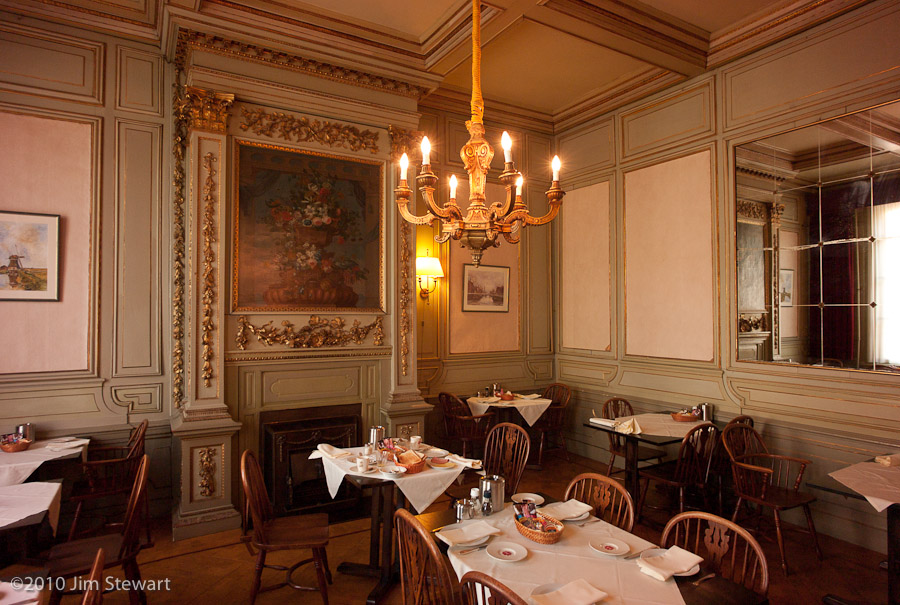
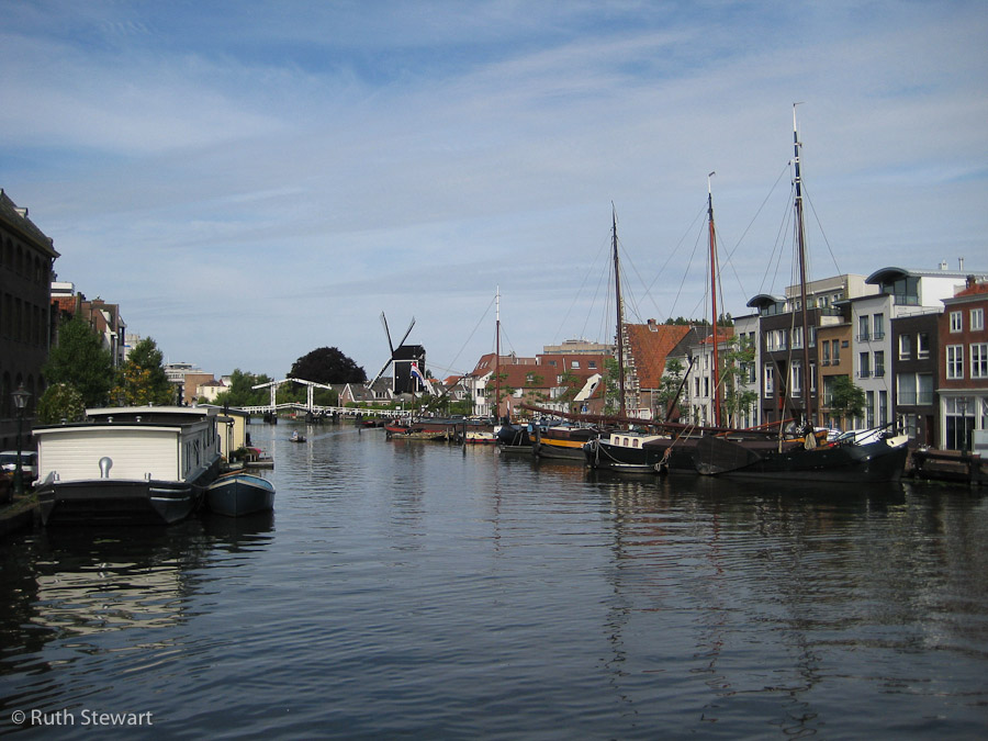
Leiden is an impressive city, architecturally akin to Amsterdam, but a quieter town and easier to escape the congestion.
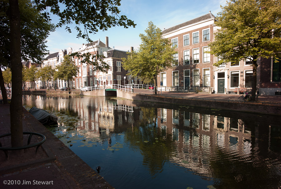
That said, it’s not a good idea to bring a car into the central part of Leiden, where the streets are mostly one-way and attempts to get from A to B generally involve passing via C, D, E, F & G as canals repeatedly open up in your path and force lengthy and circuitous diversions.

Our hotel room overlooks a canal, and also an English pub. Not really what you want to find when you’re nearing the end of a trip. But at least the clientele is Dutch.
The hotel itslf occupies one of the grand merchants’ houses which line so many of the canals
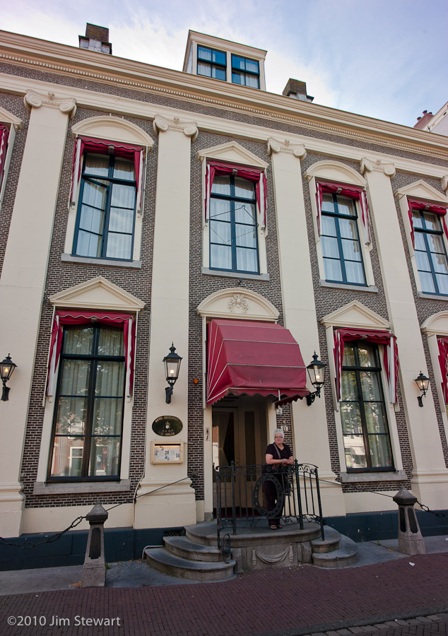
and a strong sense of faded grandeur pervades it
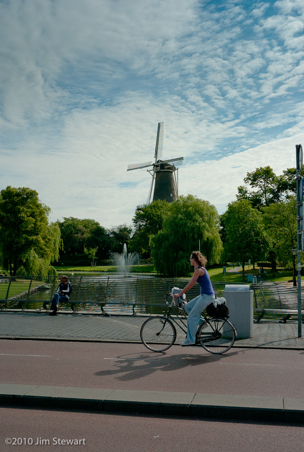
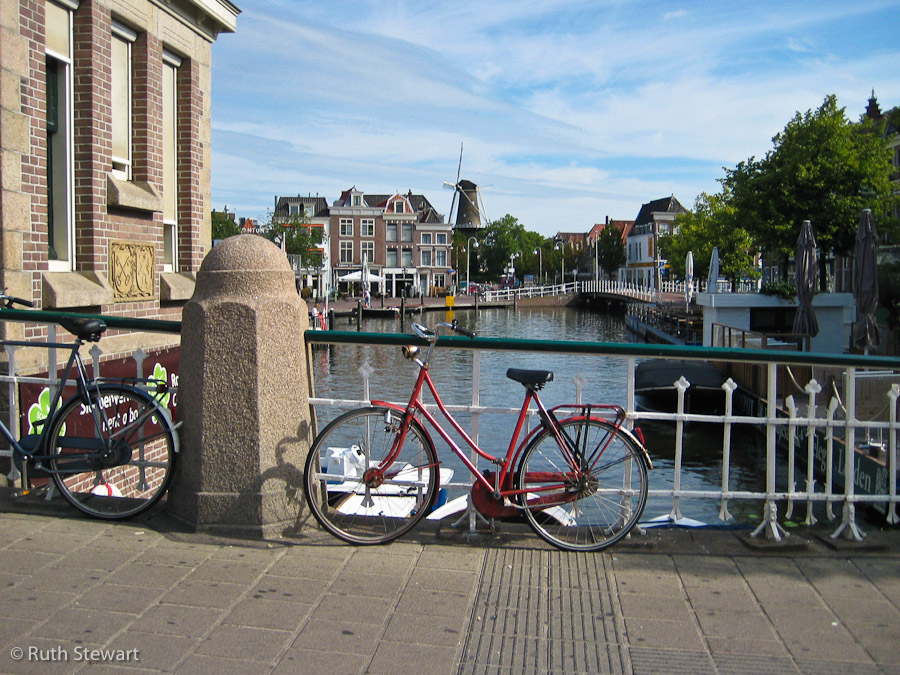
The town itself has a more modern feel: impossible to image Holland in the days before bicycles, or to envisage a future without windmills
And that’s about it for summer 2010. Next day was up to Ijmuiden and aboard the ferry back to Newcastle-upon-Tyne.
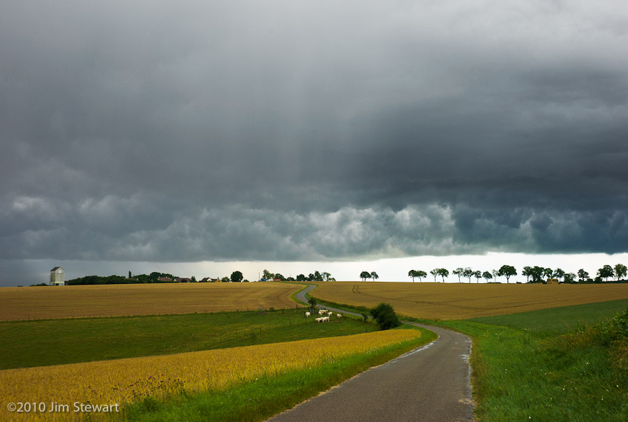
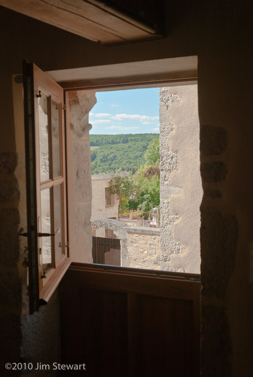
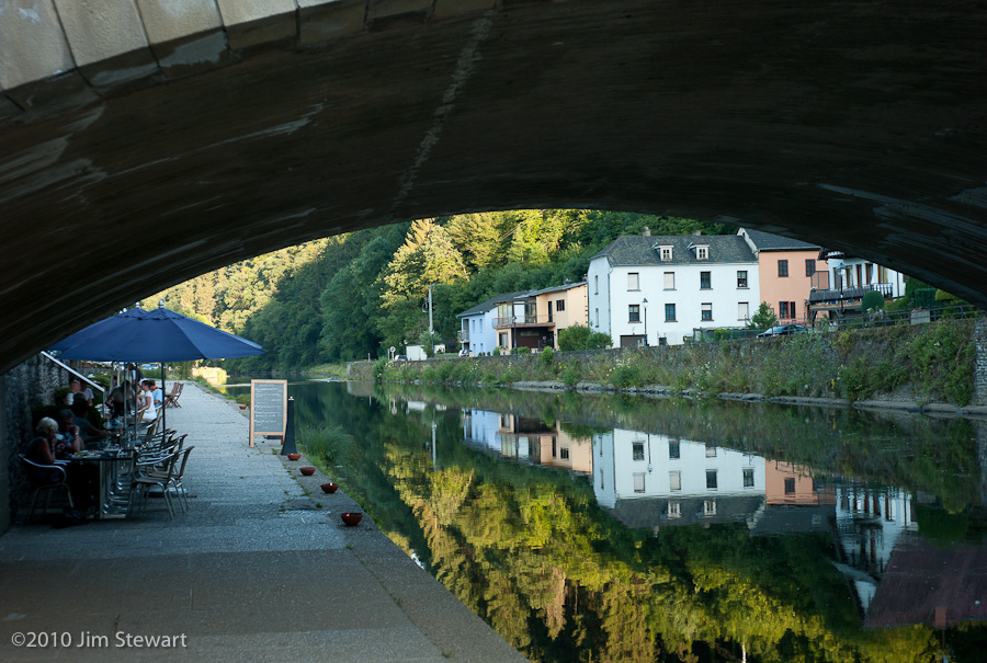
down the Moselle, below the vines...
30/07/10 09:43
... lies the best kept secret in wine?
See wine writer Tom Canavan on Luxembourg’s wines here
We spent a day rambling down the Moselle valley, with the better-known German Mosel vineyards just across the river from us. In the village of Éinen, the vines come right into the built-up area, and there seems to be little distinction between horticulture and viticulture
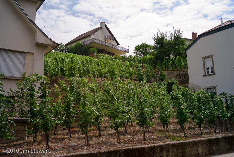
The signs of wine-making are everywhere in Éinen

And the wine? Well, we tried some Letzeburgesch fizz, and found the stuff from Domaine Bernard-Massard in nearby Grevenmacher particularly agreeable. A fraction of the price of a champagne of comparable quality. Wish we could find it back in the UK. Maybe next time we’ll haul back a case or two...
A mighty river the Moselle! Markers on the wall behind Bamberg’s Hotel show heights reached by flood waters during past inundations of the Moselle (click the pic to enlarge).
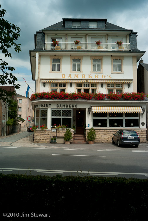
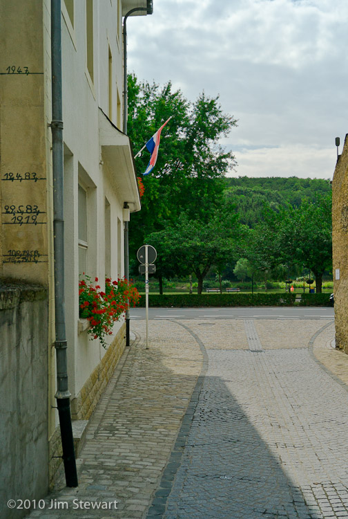
Haven’t been able to find much about this, but the 1947 flood waters reached a depth of 4 metres. An idea of just how widespread the devastation this must have caused would have been can be seen from the shot below of the Moselle valley taken at an altitude of less than one metre above the river’s normal level, from the exact same spot as the picture of the Bamberg’s hotel (above left) was taken. A 4 metre flood would have submerged most of the buildings in this shot, and lapped over Bamberg’s flower-covered balcony.

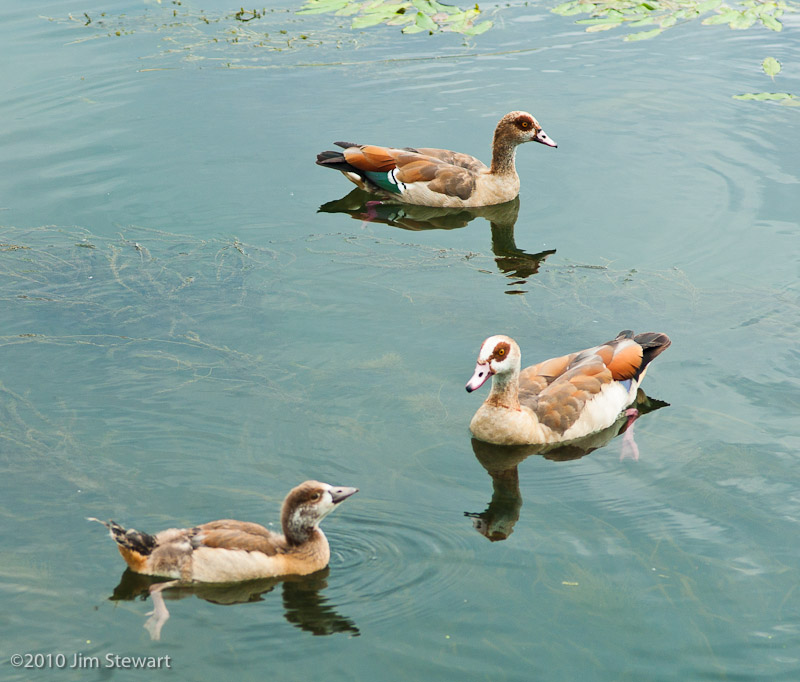
Surprises in store on the ornitho front as well. We’d not expected to run into these critters again
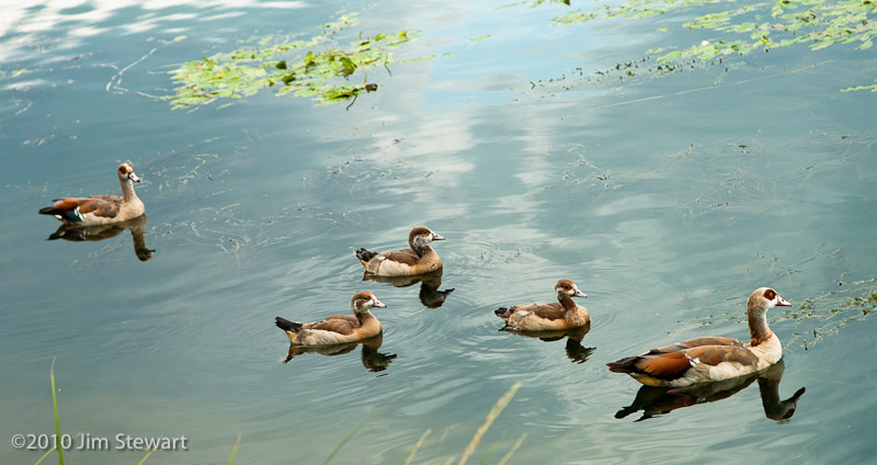
Last ones we saw were in the dam in the Pilanesburg National Park in South Africa, and anyone who got a Christmas card from us last year may recognise these as Egyptian Geese, same as pictured on our card
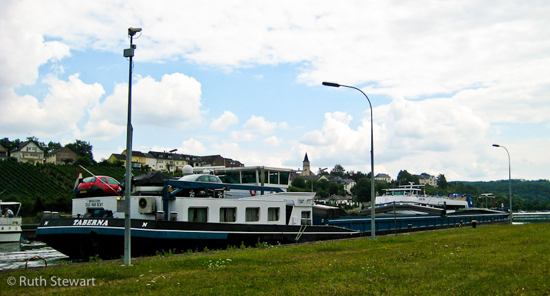
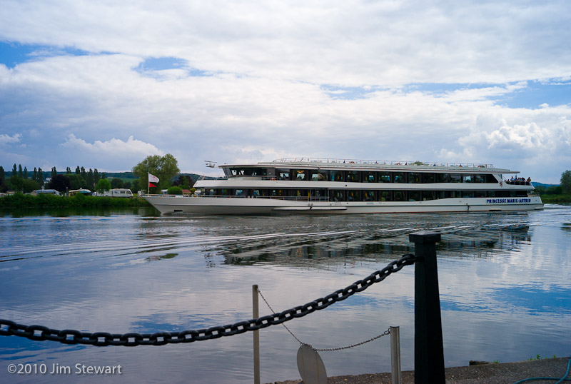
There are some surprisingly large boats on the Moselle, too. Quite a lot of them, in fact, both barges and cruise ships. Here’s a couple of examples: it really is quite difficult to convey the sheer scale of these - don’t forget to click to enlarge...
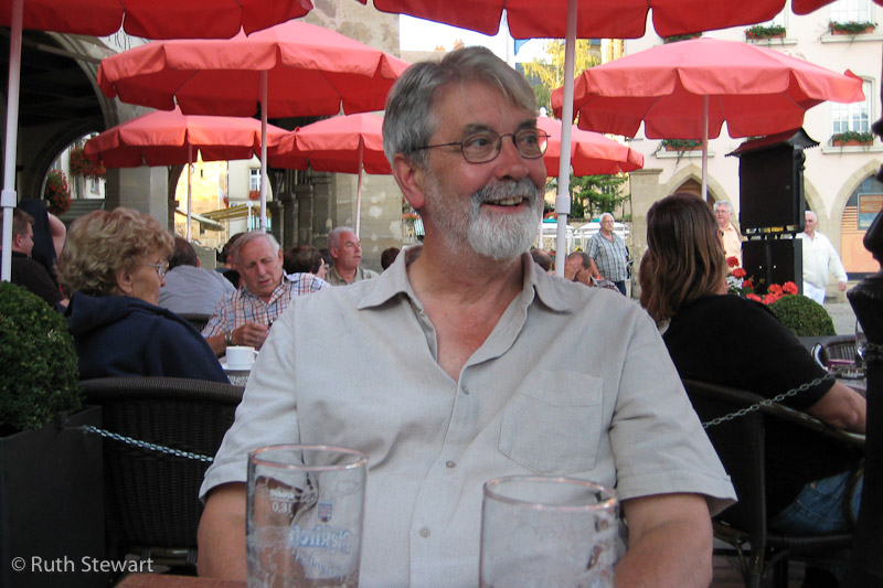
To Remich, one of the bigger Moselle crossing points, for lunch. Jim looks like he enjoyed it
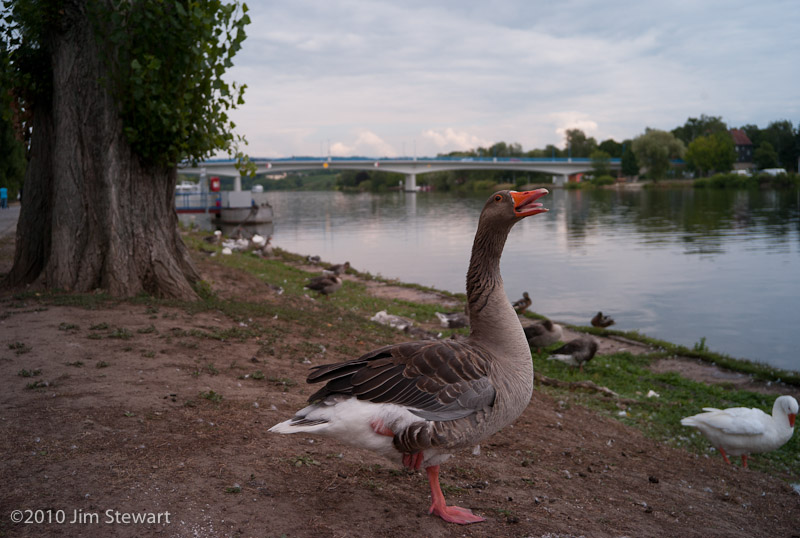
And finally : not all the geese were Egyptian. We ran into this stonker-honker after lunch
if it's Wednesday
28/07/10 23:02
it must be Germany.
Got seriously lost on the 10 mile trip here from Echternach, and very seriously lost on the (must have been 40 miles) trip back.
But here we were, on a Wednesday afternoon, in Trier. Reputedly Germany’s oldest city
but really only known to us as the birthplace of one who probably wouldn’t like what they’ve done to the old place any more than he’d probably have liked the old place back then
before they named a street after him.
to town
27/07/10 22:57
to Luxembourg city that is. By bus.
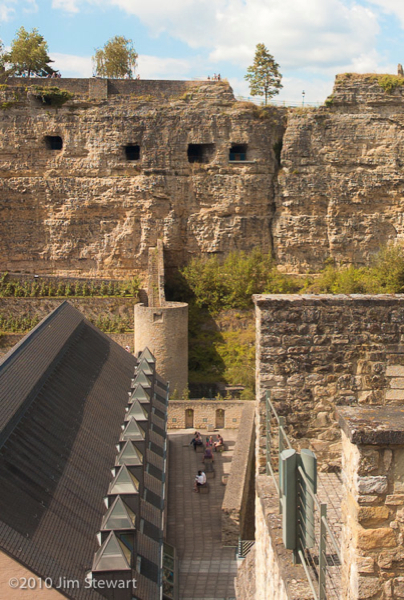
To explore on foot. Luxembourg is a surprising city, with a long history and a particularly unlikely location for any city, let alone a capital.
The city straddles the deep, wooded gorge of la Petrusse
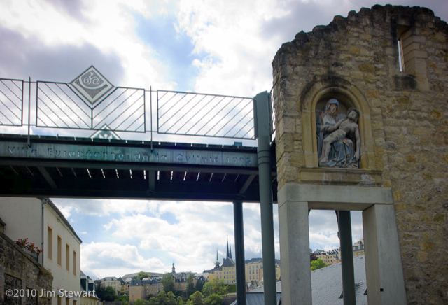
We walked the gorge. Under bridges
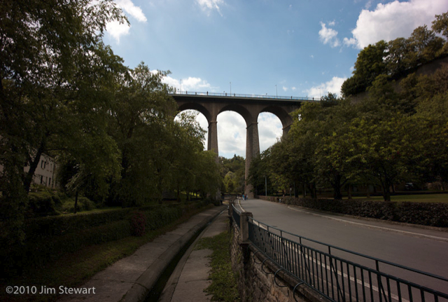
and the fortifications of the medieval town
through old and new
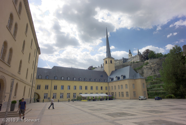
by the Abbaye de Neumünster
along the riverside
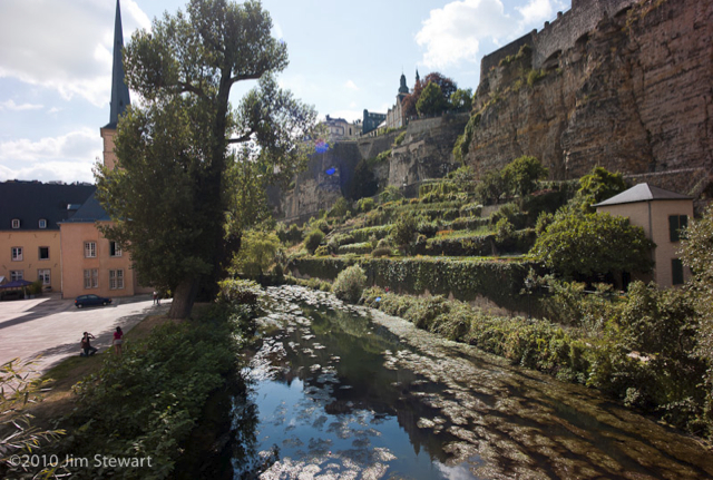
and back up into the town
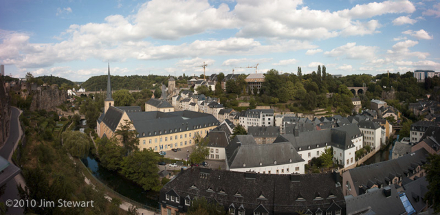
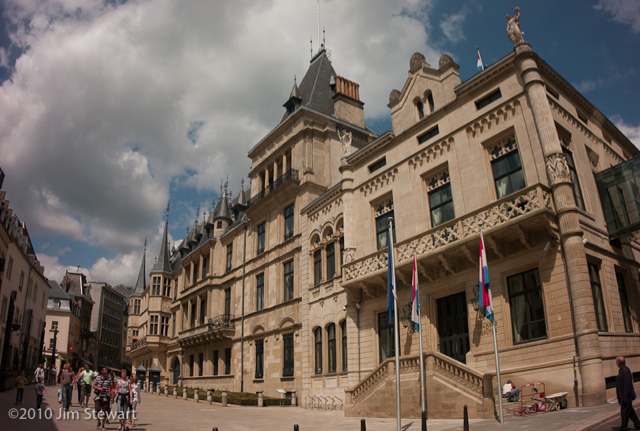
Oh yes, and of course it’s a Grand Duchy, so there’s a Palais Grand Ducal
and a cathedral too
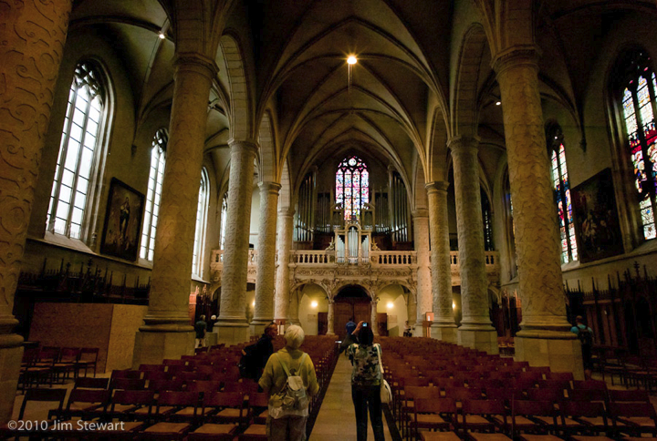
(post-war rebulit: Luxembourg was in the “Bulge”, when Patton came through)
And then it’s back on the bus, and back to Echternach, and our room in the Hostellerie de la Basilique, overlooking the Place de la Marché
that night in Belgium
25/07/10 23:38
we ate in a riverside café below the castle in the Ardennes town of Bouillon...
... and camped in the nearby village of Poupehan. Camping du Vieux Moulin, beside the river Semois. Idyllic, riverside camping? Sadly not. Will we be going back there? Certainly not - indeed, the experience of one night at Camping Le Vieux Moulin at Poupehan was just about enough to put us off going back to Belgium at all.
Why? Well, it wasn’t because of the slightly scary way we were forced to set up our tent in precise alignment with other tents and caravans.
And it wasn’t really so much the fact that a small group of 20-somethings decided to party, long, loud and drunkenly, until 3 a.m.. No, it was more the fact that the management of the campsite just let them get on with it, until 3 a.m.! And then, in the morning when we checked out, the manageress expressed horror at the “scandaleuse” events of the night, and would accept no responsibility for the “scandale de direction” that we’d had to put up with.
End of moan. Onward, into Luxembourg...
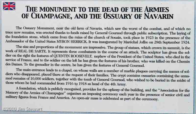
nothing remains
25/07/10 18:35
of the Ferme de Navarin. Neither of the village of Perthes-lès-Hurlus.
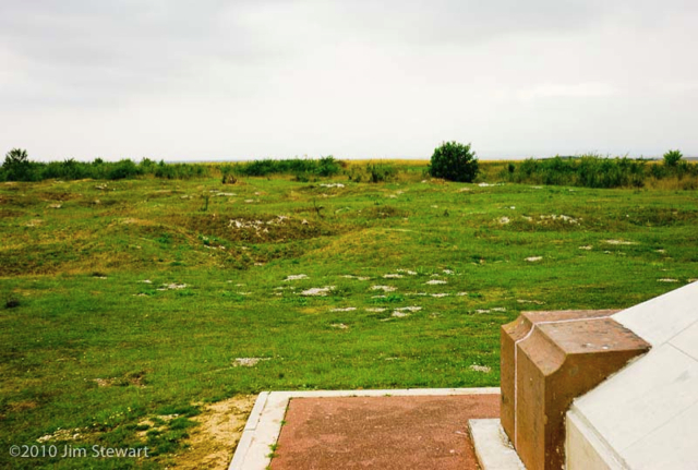
But the site of the ill-fated farm is all too conspicuous: the site now of a Memorial, and an Ossuary. One of the most moving things we’ve either of us seen, and we saw it on a suitably grey day.
The D977 north-east from Chalons towards the Ardennes crosses the flat and rather featureless terrain of Champagne, and beyond the town of Suippes traverses a shooting-range still used by the French army. On a crossroads about 3 miles north of Suippes is Souain-Perthes-lès-Hurlus, This reconstructed village occupies the site whereon was destroyed the village of Souain. The once-nearby village of Perthes-lès-Hurlus survives only as a name appended in a manner ironically reminiscent of the French villages’ habit of appending the name of their finest vineyard, as in Nuits-St. Georges, or Puligny-Montrachet.
Souain-Perthes-lès-Hurlus has barely 10 inhabitants for each letter of its name.
Both Souain and Perthes-lès-Hurlus were destroyed in the ravages of of the First World War.
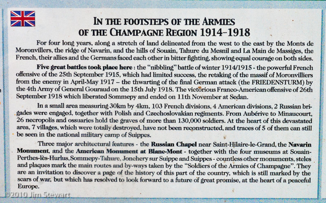
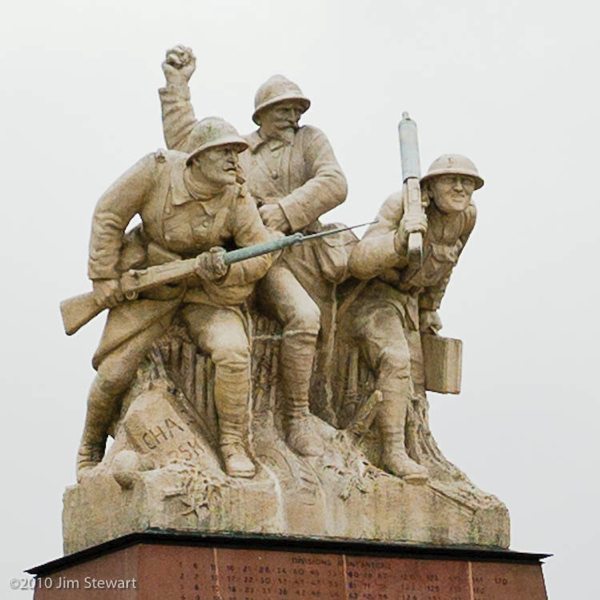
A couple more miles north up the D977 we reach the site of the Ferme de Navarin, now the site of the Memorial and the Ossuary of Navarin, where lie the bones of 10,000 fallen combatants of the French, German, American, Russian, Czechoslovak and Polish armies who fought for four years over a front 30 kilometres long and no more than 4 kilometres deep in the Battle of Champagne, 1914-1918.
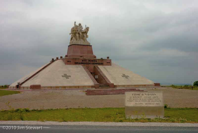
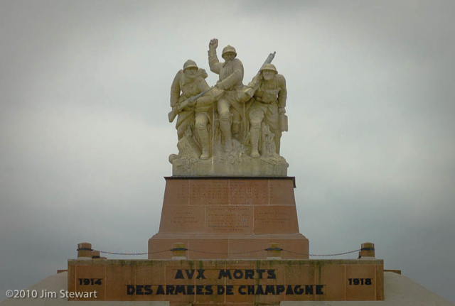
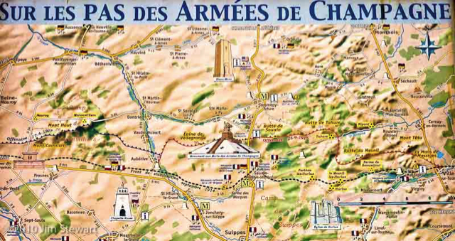
The map above shows the positions of the front line, and the minimal scale of its movements, between 1914 and 1918.
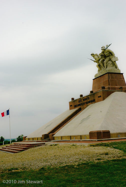
A little work back home turns up some interesting context on the Navarin Monument, its place in history and those of its creators.
The figure in the middle of the statue is General Gouraud, who commanded the 4th army in the Champagne/ Marne battlefield on and off from late in 1915; undertook the final, successful, offensive in September 1918, and led the project to build the memorial. The sculpture itself is the work of Maxime Real del Sarte, an active member of the far-right Action Française group, and a leader of their youth movement Les Camelots du Roi. So there is perhaps, in this monument, and in del Sarte’s sculpture, some undertone of triumphalism, of the spirit of reparation that blighted Versailles and led to the collapse of German democracy into Nazism.
Nonetheless, it is impossible not to be moved by standing in the boneyard of Navarin, where the landscape still seems to bear the pock-marks of the shell-holes in which so very many died.
farewell to Flavigny
24/07/10 23:37
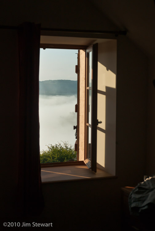
on a misty morning
we awaken to find the valley hidden from view from our windows
 >>>>>>>>>
we wave goodbye to Flavigny, to Jean-Luc and Marte Tahon who’ve been our excellent hosts here, and to Françoise, Philipe and Leonard who were our neighbours and fellow-visitors. While they head south for their home in Hyères, we head north.
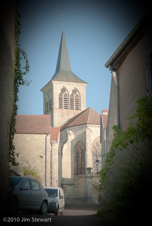
It’s a little sad to open our door and see Flavigny and the église Saint-Genest for the last time
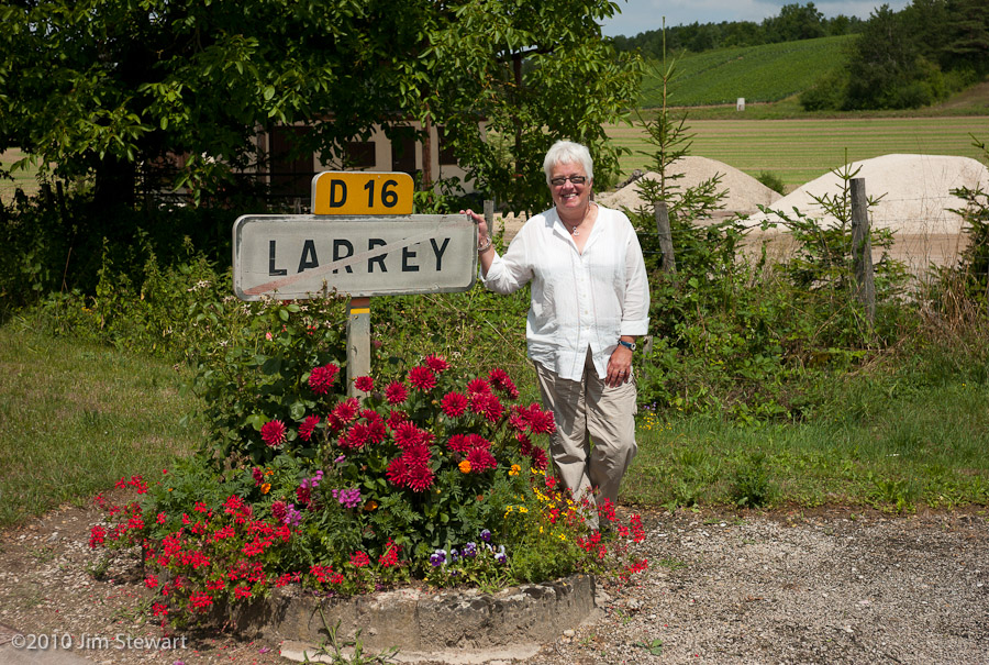
but on we go, and Ruth for one seems happy at Larrey (ho, ho, ho) as we near the northern perimeter of la Bourgogne...
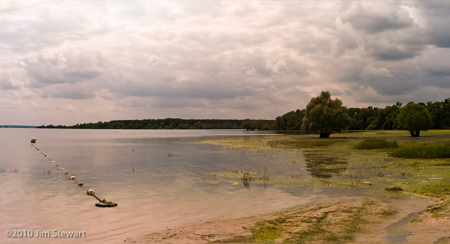
We thought maybe we’d find a lakeside campsite, and checked out the Étang de Marcenay and Lac d’Orient (pictured). After all, as noted previously, Les Francais aiment leurs Lacs. But thinking about it, we live in the land of lochs, and of course Argyllshire has more coastline than France, so maybe we’re just a bit picky when it comes to lacs, lochs and lakes.
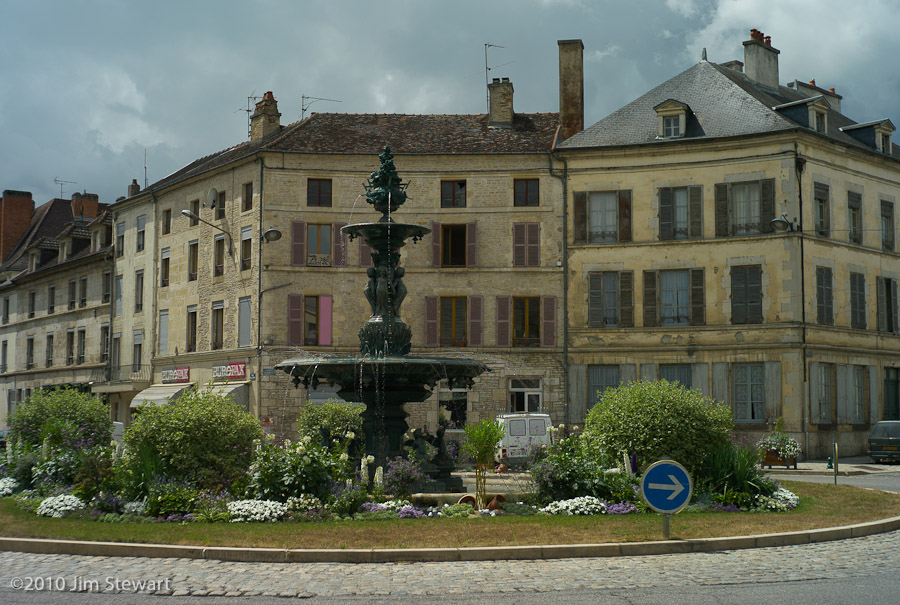
Anyhow, after much nosing around, we ended the day in Champagne, in the Côte des Blancs vineyard area, in the village of Vertus, and the Hôtel Thibault IV, a ** Logis de France, and not one we’ll want to revisit. Along the way we passed through Troyes (which looked worth a visit - we may go back) and Épernay (which didn’t. The Rough Guide likes it, and gives a seriously misleading picture of a quiet little market town. We didn’t find that.)
This is Vertus:
Note the grey sky...
the day goes on...
23/07/10 20:42
storm clouds and downpours come and go
We stop for lunch in Chatillon-sut-Seine...
...drive a ways across the countryside in this most northerly part of the Département de la Côte d’Or, dodging downpours...
...and searching for Paris, and the source of the mighty River Seine.
Then all at once we’re there, at the veritable Source de la Seine...
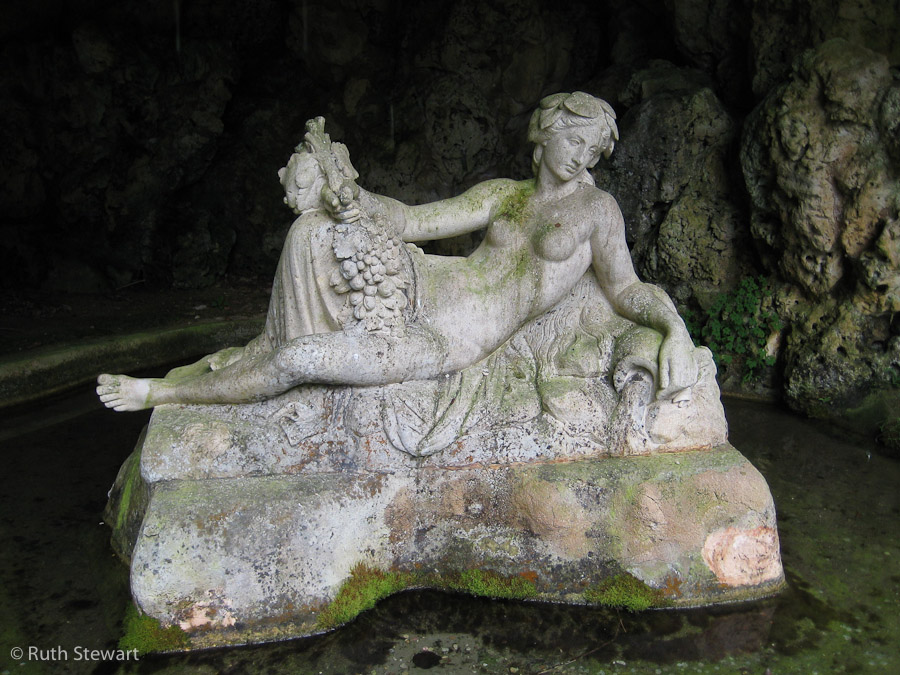
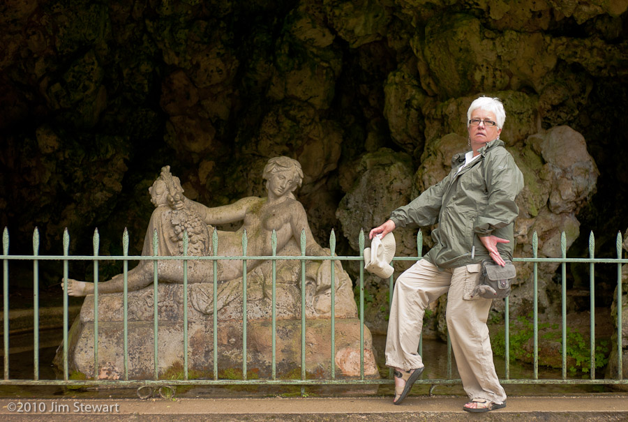
... where the goddess Sequana lolls atop the spring itself in a grotto. This is a little outpost of Paris, administratively as it is aesthetically, in the depths of the northern Côte d’Or, no more than about ten miles east of Flavigny.
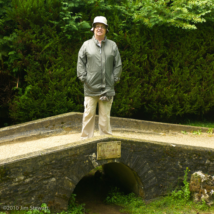
In these pictures Ruth ambles across one of Paris’s least-known bridges, the Pont Paul Lamarche (1902-2003),
and poses alongside La Reine de la Seine herself, seemingly assisting her in her riparian endeavours!
Then it’s back to Flavigny.
The sun finally breaks through over the town as we descend towards the Vignoble de Flavigny-Alésia in the valley below
and repair to the Maison du Vigneron to break out a bottle of “Demoiselle de Laizan”, the Vignoble’s not-half-bad Vin Effervescent.
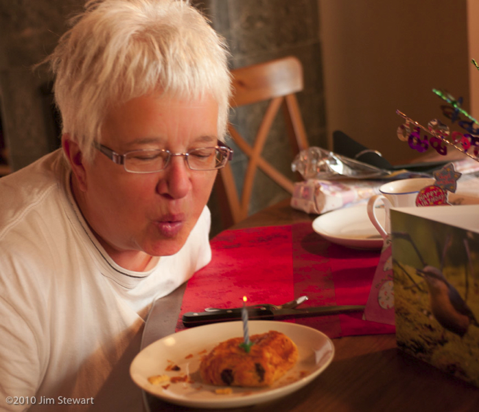
For we still have a birthday to celebrate!!!

the day begins...
23/07/10 10:09
...with a birthday breakfast for a birthday girl
Never divulge that certain age, but it’s a big birthday!!!
a rainy day in Flavigny
21/07/10 23:17
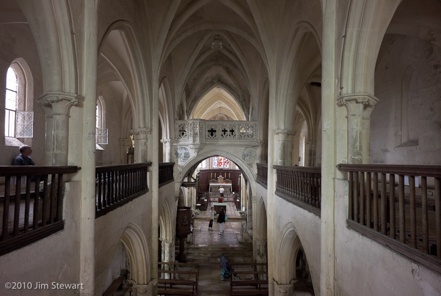
is an opportunity to explore indoors. Starting of course in the church.
And as we can, we start by going upstairs in the church
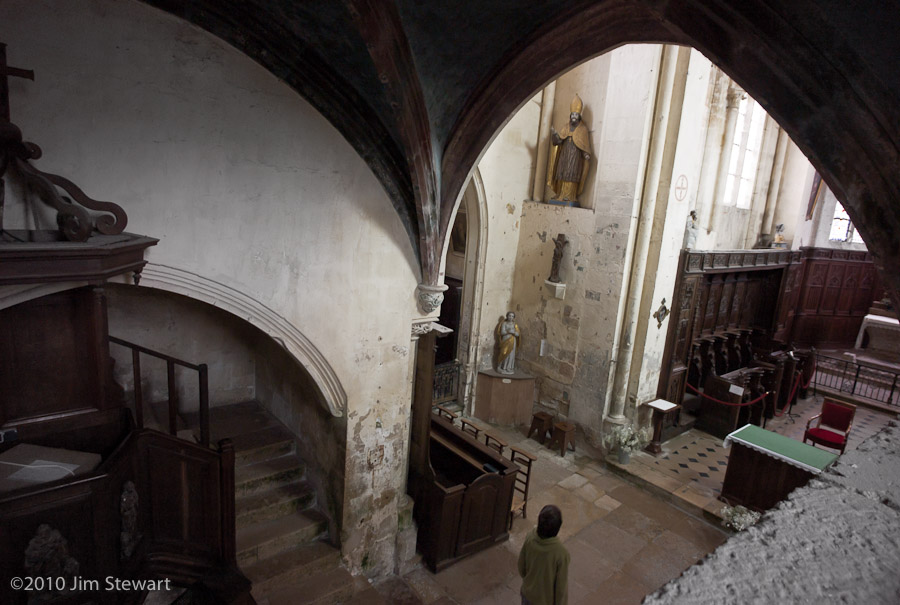
Downstairs, virgin and child appear
The weather does not improve, but there’s a wonderful stormy light in the sky, which deepens as the hours go by.
This is 4 o’clock:
By 9pm the light is further enhanced by a rainbow, seen here over the roof of our neighbours’ house

And as the light starts to fade, we walk back up to the church, still louring over the town as the sun sets over the hills
nighttime in Flavigny
20/07/10 18:31
as dusk descends, l’Église Saint-Genest lours beneath the “blue hour” sky
 ...a gargoyle leaps in the last rays of day...
...and ghostly children lurk outside the walls
 until at last night falls
around & about Flavigny (2)
19/07/10 18:31
down the road apiece....
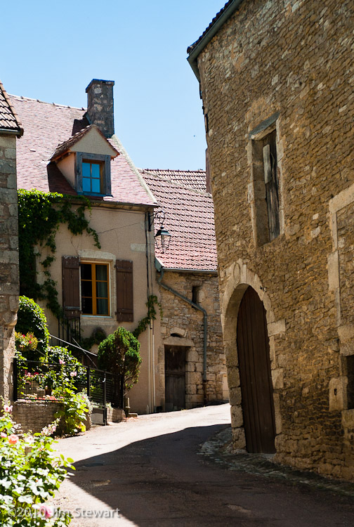
The search for a supermarket had already led us to Semur-en-Auxois on the way up to Flavigny yesterday, and now was a chance to look around this scruffy but interesting and history-laden town.

So quiet, for a summer Sunday afternoon.
(The new Tuscany???)
around & about Flavigny (1)
18/07/10 13:31
settling in to having a roof over our heads and a kitchen to cook in
and this to look out on while eating our breakfast
A day to begin to explore the environs.
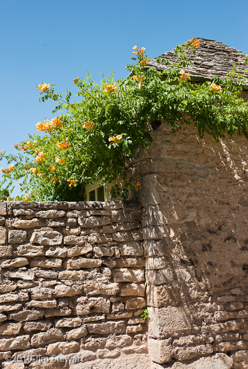
Some pictures of Flavigny’s streets may give an impression of the feel of the village:

to Flavigny-sur-Ozerain, and "La Maison du Vigneron"
17/07/10 17:53
if our 2010 holiday had a centre, this was it
After exploring some new parts of eastern central France, we headed today to our gîte in the village of Flavigny-sur-Ozerain, towards the north of the Côte d’Or Département in Burgundy. Is Burgundy the new Tuscany? Wait and see...
Not too far from Cluny to Flavigny, but we ambled along, checking out campsites at Beaune and Savigny-lès-Beaune for future reference along the way. The Beaune site (“100 Vignes”) looks to have potential, though we’re not sure how long we’d want to spend in the bustling wine town itself, and it’s a fairly urban site. Savigny - also not sure, though nearby Pernand-Vergelesses looked pretty, and would make a good centre for a slurping-tour of the Côtes.
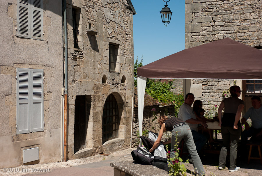
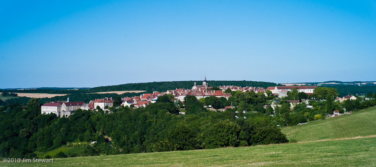
First view of Flavigny was the best known (from pics on the web) view, across the valley from the N9 up from Pouillenay:
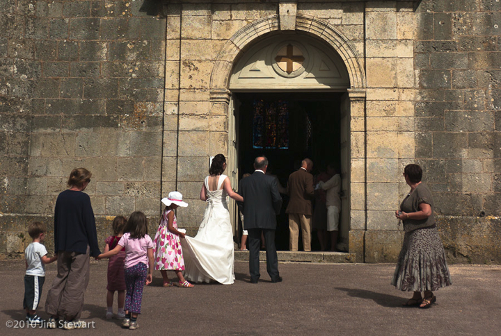
On arrival, a quick look round the village. All was pleasingly quiet - aside from the racket out of this wedding party. Can’t you just hear that confetti?
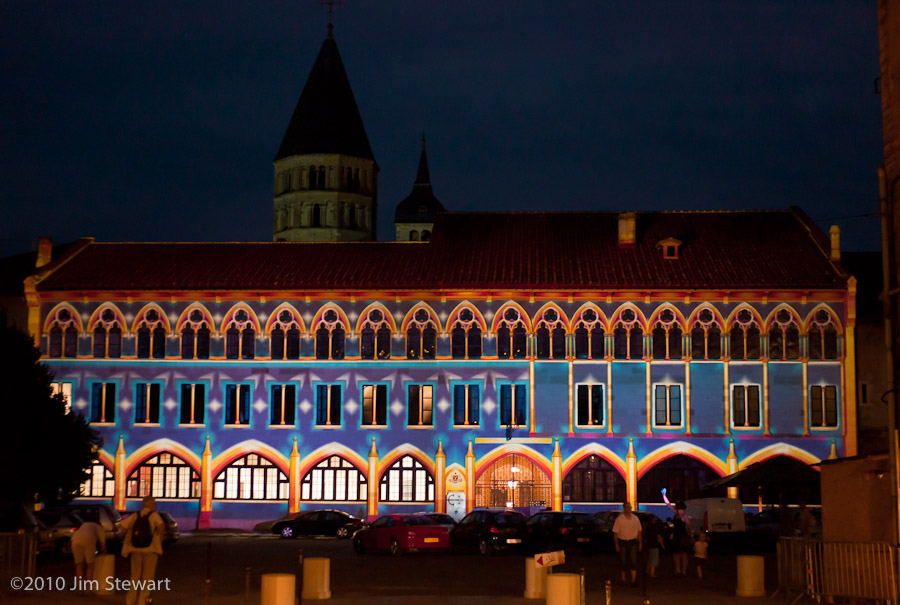
Cluny la Soirée : Rêves de Lumière & a "Scottish" Band
16/07/10 23:59
... back in town and we’re back for a second evening meal at the Brasserie du Nord
The sun is setting
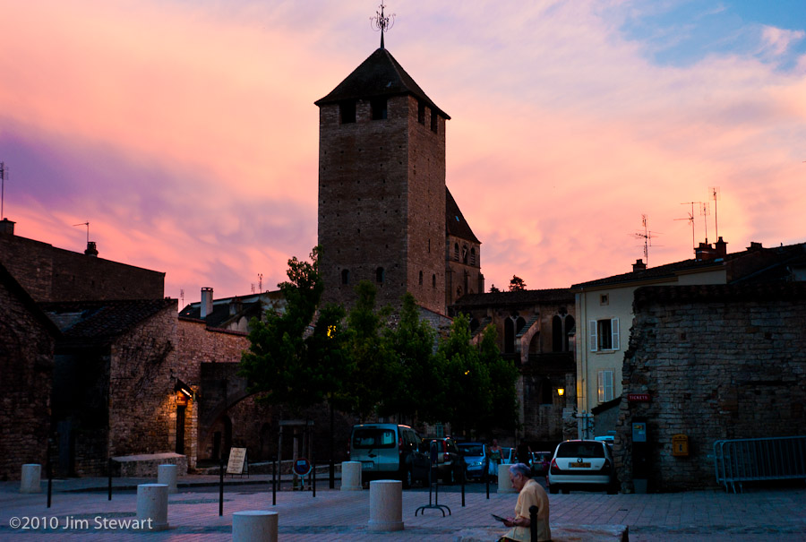
and a remarkable transformation is occurring before our eyes. A “Mise en Lumière” on the facade of the Palais du Pape Gélase, a part of the Cluny 2010 celebrations, and the work of the light artist Patrice Warrener and his Chromolithe Polychromatic Illumination System.
Here’s little .swf presentation of the development of the work:
Cluny2010(click to view - you’ll need to use your browser’s “Back” button to get back here)
Here’s the view from across the square:
Picture of the night in the square, though, has to be this one from Ruth, of a little extra piece of the “Mise en Lumière” right on the terrace of the Brasserie du Nord
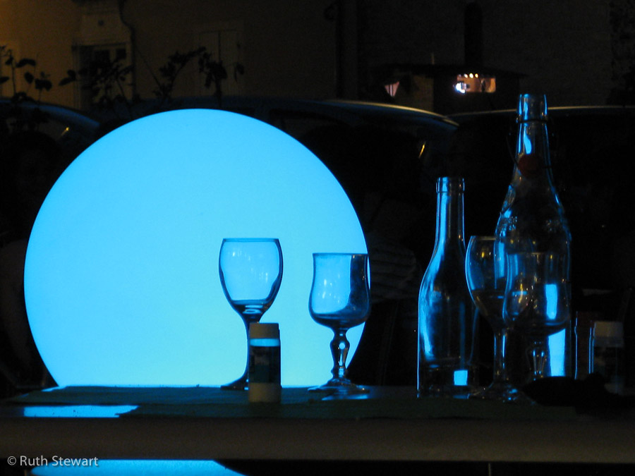
(The light in the background of this picture (top right) is the location of one of Warrener’s projection units, from which the “Rêves de Lumière” lights were beamed to the Palais’ facade)
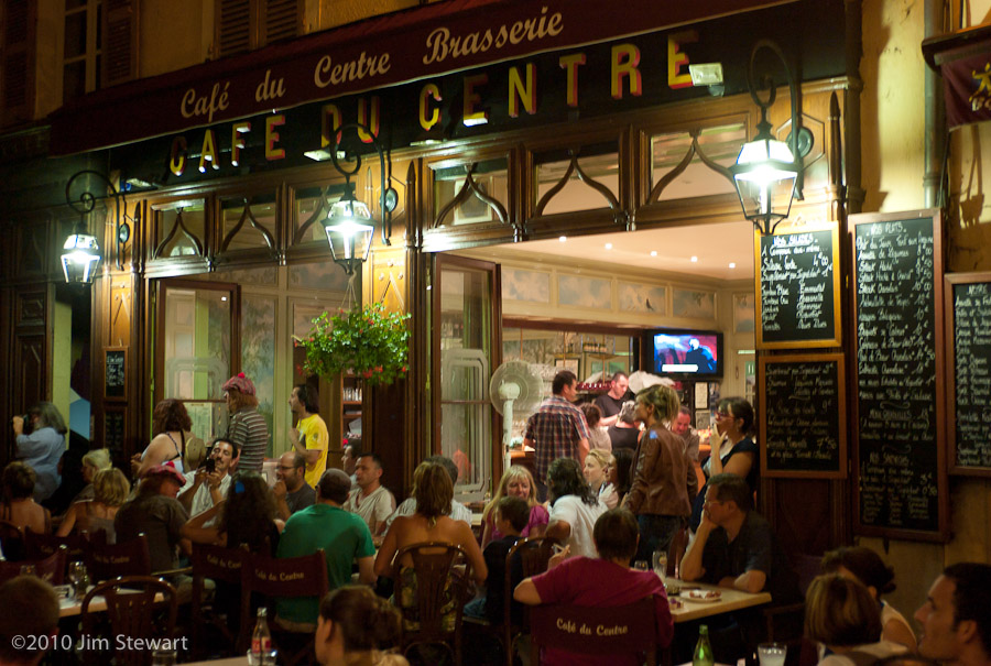
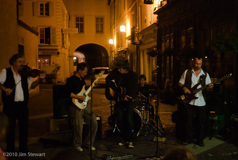
So once we’d seen that, there was nothing for it but to hit the Café du Centre, to check out the “Celtic Scottish Music” band:
Then back to our hotel, for tomorrow we’re off to our gîte at Flavigny-sur-Ozerain
à Cormatin, et son Château
16/07/10 17:53
not far to the north of Cluny lies the village of Cormatin
There are two good reasons to visit Cormatin, and the less well-known is the excellent Caveau du Figuier, where - amongst the racks of Grands Crus de Bourgogne - we found a bottle of Figaro, a wine from the family Guibert of Mas de Daumas Gassac renown. We’d go back there!
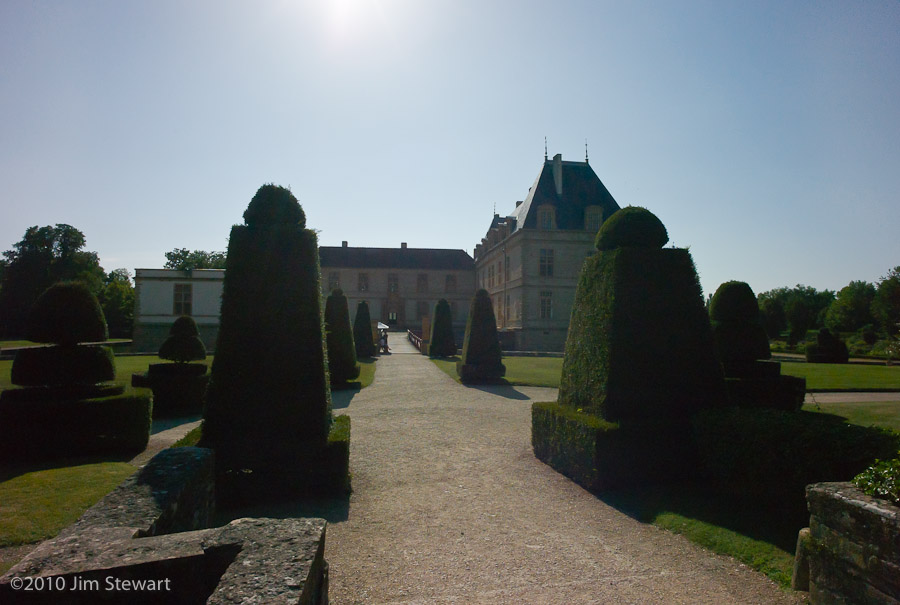
Second, and best-known, is the Château de Cormatin, its owners including the Marquises of Huxelles, the powerful family du Blé, the Lacretelles, a branch of the Lamartine dynasty, and, at the turn of the 20th century, one Ralph Gunsbourg, Director of the Opéra de Monte-Carlo.
This is the Château...

We took the tour...

...and wandered in the grounds...


(As usual, click on a pic to enlarge)
afternoon ride : Cluny to Beaujolais
15/07/10 23:50
after lunch, a change of hotel
here’s the view from our new bedroom window:
Then off south, stopping first in the hamlet of Saint Point, with its (inevitable) Église Romaine
and the (privately owner-occupied) Château Lamartine, formerly eponymously owned & occupied:
nice wee place, and a decent looking campsite nearby, so we may return!
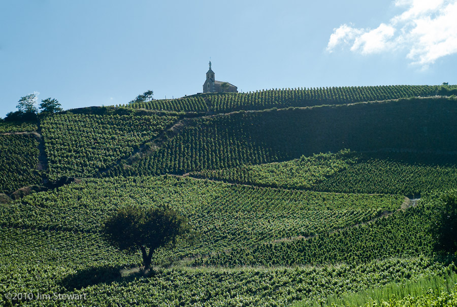
This next bit was a surprise. The posh vineyards of the Côte d’Or that we visited last trip were interesting, but less-opulent Beaujolais is actually far more scenically interesting, with far more dramatic slopes, and with some vineyards every bit as carefully-tended as anything we saw in Meursault or Vosne-Romanée (and some just as scruffy and neglected)
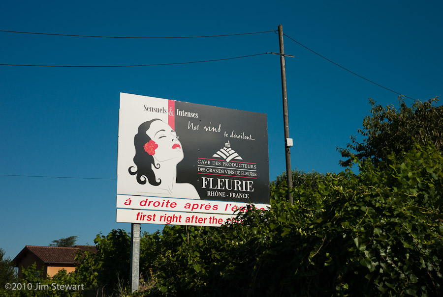
A nice style in promo here, too. She’s reminiscent of the graphic on the old Gitânes fag-packets you never seem to see in France anymore
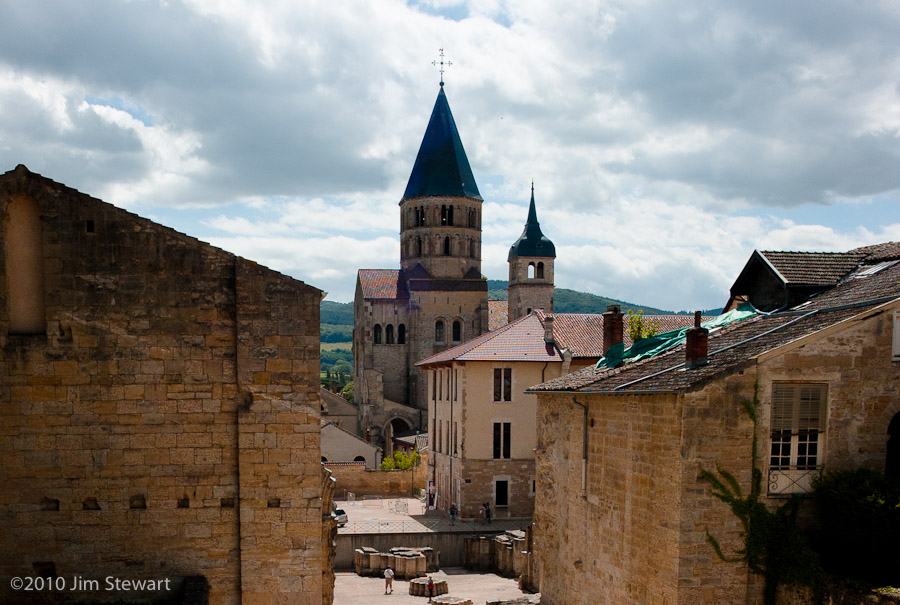
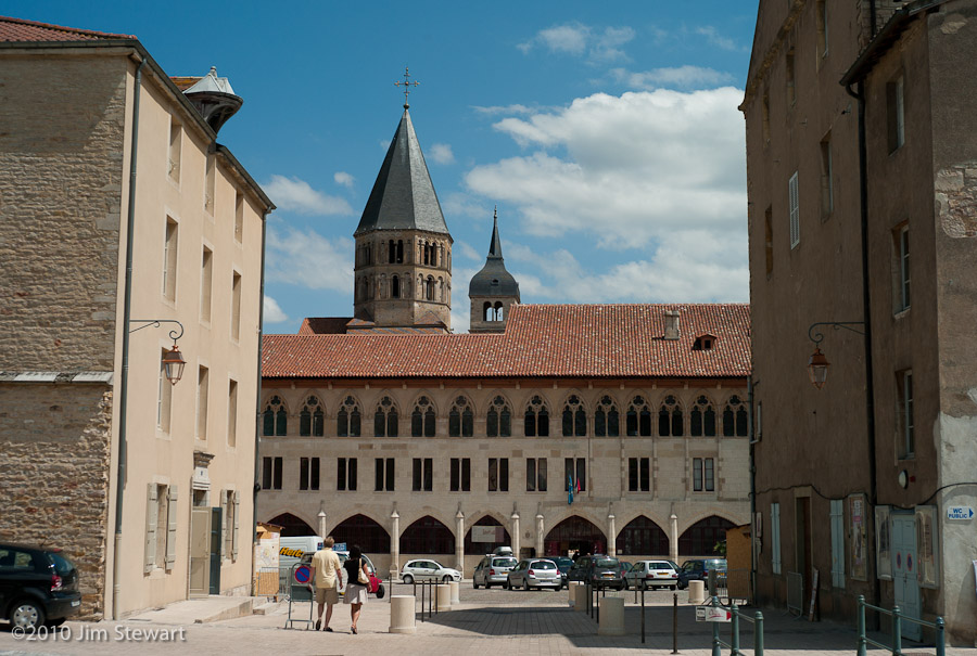
a morning in Cluny : the town with no Abbey
15/07/10 12:42
we didn’t really know what to expect of Cluny...
... the guides bang on about a ruined abbey, which to us Brit suggests something between a pile of rubble and the like of Fountains or Tintern.
The Abbaye de Cluny, renowned in its medieval day as the largest building in Christendom, was not destroyed by marauding armies. Out-sized only 500 years later by the upstart St Peter’s Basilica in Rome, before its decline and destruction, Cluny’s abbaye was a major force within European Catholicism. The Cluniac faction was dominant in the Benedictine order, shaping the political role of the church in medieval Europe and effectively running the papacy for a couple of centuries. (See wikipedia here)
The Abbaye’s decline appears to have its origins in serious financial mismanagement and overly-ambitious building programmes as far back as the 12th century. More recently in post-revolutionary France the last evidence of its former grandeur was pilfered down to its currently much-reduced size by local people in search of building materials.
The destruction of the abbey was completed by about 1850, just around the time when modern tourism could have made old Cluny into a major global destination, cf. the Alhambra, the Taj Mahal, Angkor Wat or the Vatican.
All that remains today are a few towers and steeples, but nevertheless Cluny is an attractive town which we enjoyed visiting, none the worse, and much the quieter, for not harbouring a “world class” tourist magnet!
We enjoyed our time in Cluny, and may very well return when next we hit Bourgogne. Good lunches at the Central Bar, and the beef with papardelle at the Brasserie du Nord deserves a mention.
We began our morning in Cluny not in the abbey (what abbey?) but in the church nearest to our hotel, the Église Saintt Marcel in the Rue Prudhon (yes, that Prudhon - he was from here too):
Thereafter, wandering the narrow streets and wide squares in Cluny’s centro storico, we were seldom more than a couple of minutes from some sighting of the (relatively) little that remains of the Abbaye. Round almost every corner there’s a glimpse of a tower...
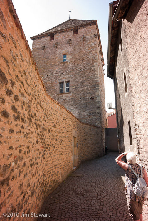
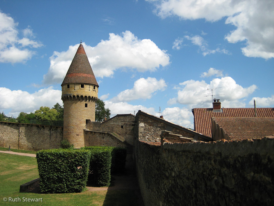
... or of the clocher of the ancienne Abbaye...
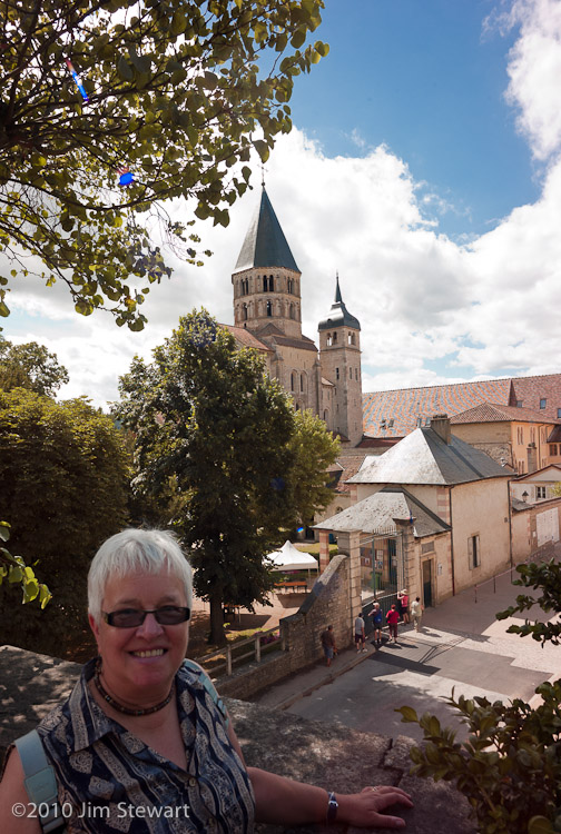
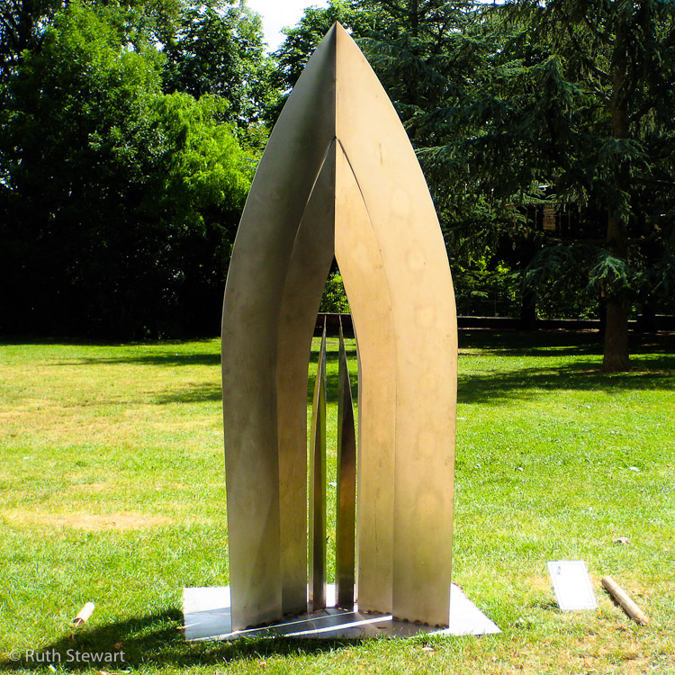
...though the town does have a contemporary cultural life today. The building at the centre of the above shot is a branch of the “École Nationale Supérieure d’Arts et Métiers”, and is this summer itself an artwork in the evenings (more on this tomorrow). Below is just one of a number of public sculptures which grace the town.
à la Bourgogne
14/07/10 23:42
off now in search of some countryside that may be less dramatic than the Alps...
...but hopefully may be a little less mobbed. À la Bourgogne, and with a freshly purchased copy of “Bourgogne - Le Guide du Routard - 2010” to supplement (supplant?) the Rough Guide.
Interestingly, the Routard seems to confirm and to develop Jim’s long-held but never well-substantiated notion that France splits in two, climatically, across a line that passes about 50 miles south of Paris: with a Mediterranean climate to the south and a broadly British type of weather to the North thereof. Not only confirms what Jim thought he’d seen, but further amplifies the significance of the line, while relocating it to a point more like 150 miles south of Paris. The chapter on the Saône-et-Loire Département begins thus:
“Si vous avez pris l'autoroute pour rejoindre Mâcon depuis Dijon ou Beaune, l'apparition dans le lointain de villages aux toits de tuiles douces et rondes à la romaine, accompagnée dans l'air d'un changement de climat et d'atmosphère, d'une lumière soudain plus gaie, est un signe qui ne trompe pas : il vous indique, mieux qu'un panneau frontalier, le passage irrémédiable du <
Roughly translated, with the help (and despite the hindrance) of Google’s translator:
“If you take the highway out of Dijon or Beaune towards Mâcon, you may notice the appearance in the distance of villages with roofs of smooth and rounded Romanesque tiles; a “change in the air” of climate and atmosphere, and a light that is all at once more cheerful. These signs do not deceive. They indicate, more clearly than any frontier marker, the ineluctable passage from the North to the South, not only of Burgundy, but also of France.
“This frontier is architectural at first: at Tournus, steep roofs covered with slates or tiles flare flat, and spread out. They take on the colour of, and are covered with, the rounded tiles of Roman Provence.
“Then we cross a language frontier : in the north of the Mâconnais a line bounds the Franco-Provençal “langue d’oc” from the “langue d’oil” of the north. Thus for example, “mas”, the Southern word for rural housing, is replaced by “meix”, its Northern form.”
And today we two pass through Mâcon, pausing only to fill the tank in the baking midday heat of a deserted but automated supermarket forecourt. But we will be in Burgundy now for as far as we can really foresee, as this is Wednesday and on Saturday we have to be at Falvigny-sur-Ozerain, where our gîte will await and where we will stay for seven nights.
From Mâcon, our wanderings take us to Cluny, where we arrive just before the thunder, and grab a bed in a Logis. Full board - it doesn’t look like the rain will stop tonight. Strange encounter in the dining room that evening: pressed to order an aperitif, Jim plumped for a Campari soda. The waitress brought a glass of Campari and a bottle of Schweppes tonic water. When Jim questioned this, she informed him they had no soda, and anyway Campari with tonic is “meilleur”. Be warned, dear reader, it’s not! Jim drank what little he could, and it didn’t show up on the bill. So that was a’igh’n’e’end.
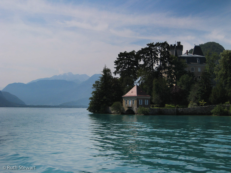
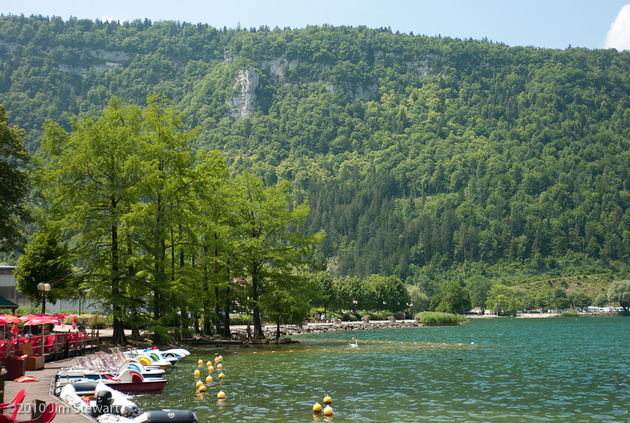
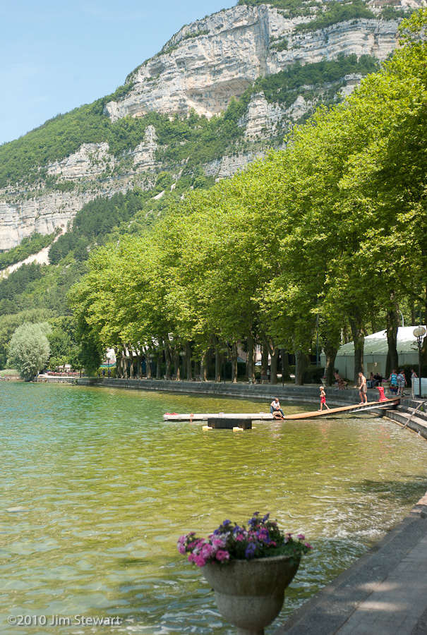
looking back over Lake Annecy
14/07/10 12:51
we’ve no pics bearing this date, so, before moving on, here’s few shots by way of an Annecy retrospective
(as usual, click on image to enlarge)
 l’Église de Sevrier at Sevrier
  the campsite at Doussard
 jetty at the campsite
sailing back from Annecy:
the Château at Duingt, again
 fellow passengers
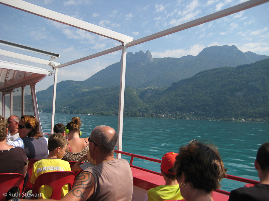
 Ruth in Annecy
 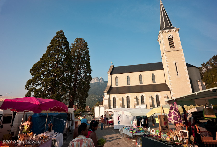 street-market in Duingt
That’s it for the Alps for this year, then.
Will we be back??
Hope so, but it would be good to visit such a dramatically beautiful part of the world outside the main tourist season. Our memories for now are of a beautiful, but bustling, overcrowded and resortified area, awash with tourists and traffic.
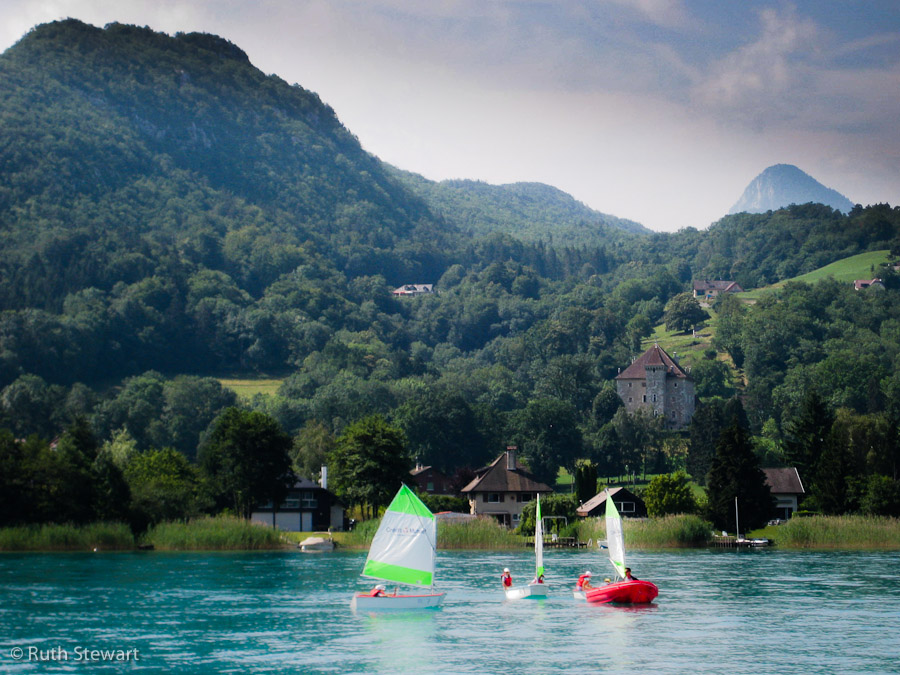
up the Lac to Annecy
13/07/10 10:14
took a boat - “La Belle Étoile” - from its landing-place just by the campsite
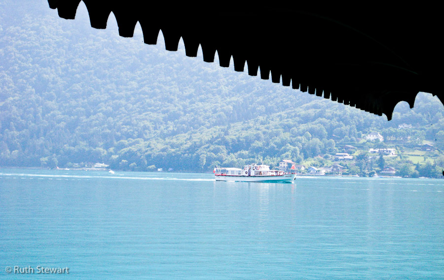
up the lac to Annecy, stopping along the way at a number of the small lakeside towns and villages...
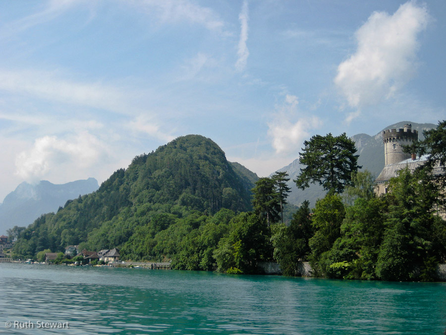
most of which seem to harbour at least one castle...
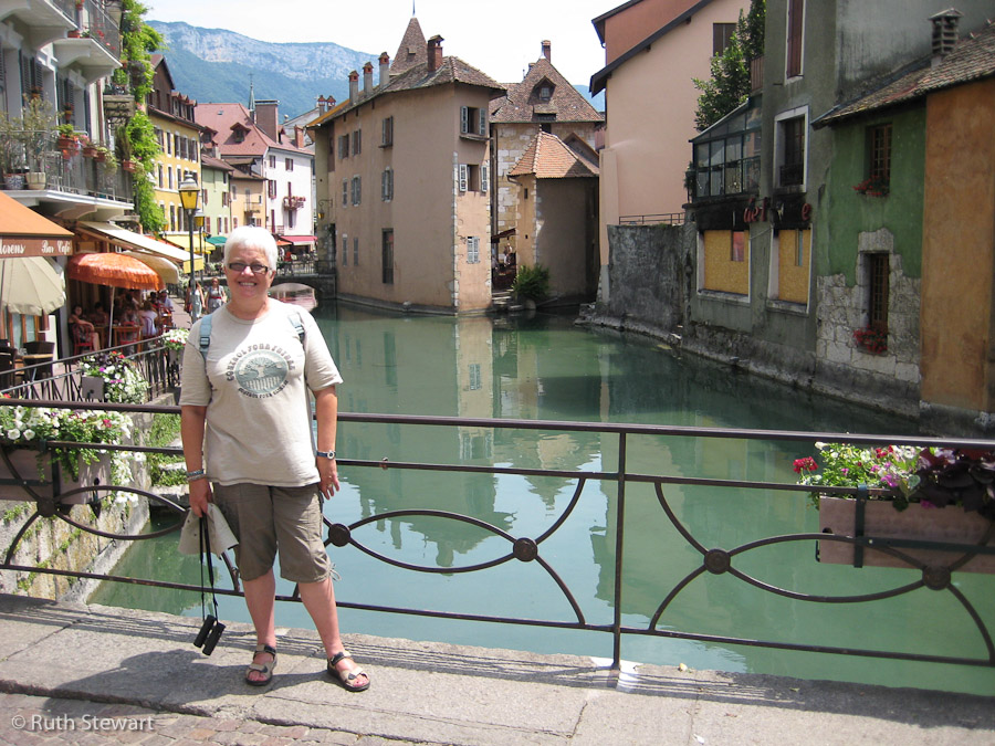
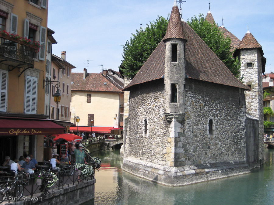
Annecy is a busy town, its streets bustling with meandering tourists and purposeful locals. Main photo opportunity postcard-style is at the island prison, just off the harbour, in the town’s ...wait for it... ”petite Venise” in this case aka “la Venise des Alpes”. In this shot Jim waves to the camera, in true seaside snapshot pose...
Plenty of good lunch places, but Jim had tp pick the naff bar next to one of the best. Ho hum...
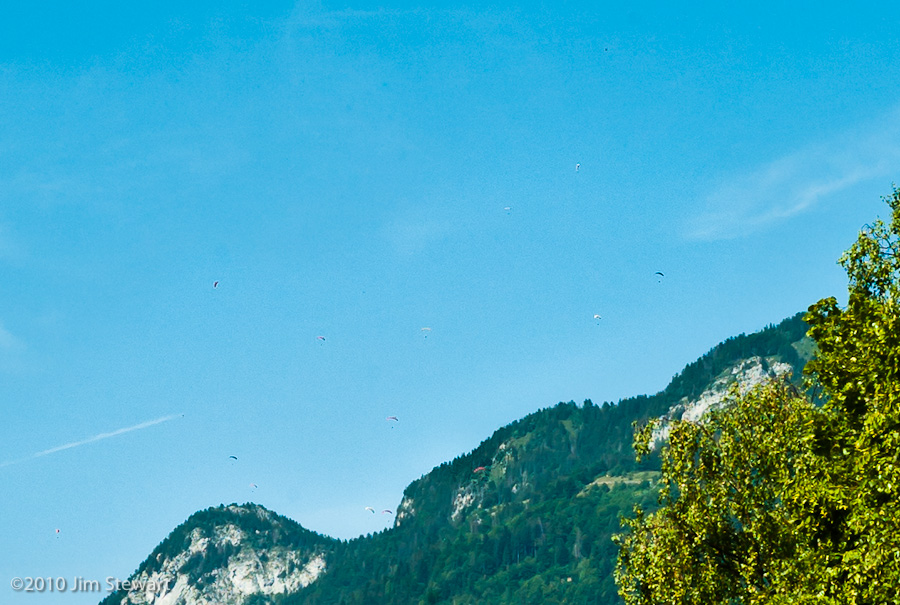
Once again, on the return sail, the skies above the lake filled up with paragliders

and Duingt emerged from the haze, framed by the mountains to the south of the lake

Later that night, in the campsite bar, after a meal of Cassoulet de Castelnaudry cooked on our bluet stove (straight from the tin), the chef relaxes
into the Mountains
12/07/10 10:13
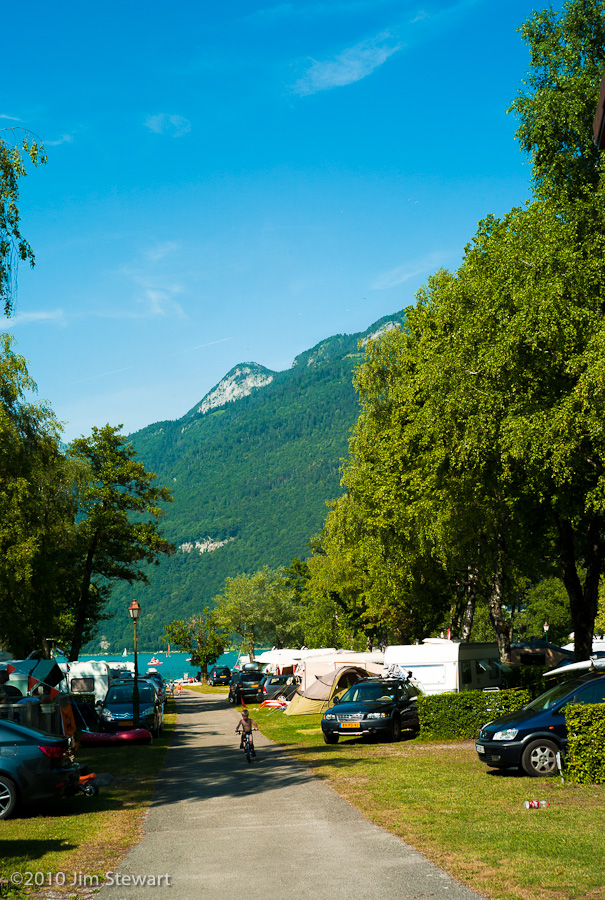
up in the hills above the eastern shores of Lac d’Annecy
the scenery and the architecture are Alpine
and we dined on local cheeses (Raclette and Tomme de Montagne are memorable) and salade de chèvre at the Bar Le Chamois, near Montmin
with a view to la Tournette (2351m / 7713ft), the highest peak in this part of Haute-Savoie

(click here for our location on Multimap - the red circle exactly corresponds to the camera position in pic 2 above)
day of the deux Lacs : #2 : Annecy
11/07/10 19:27
les Francais aiment leur lacs
and this one was busy.
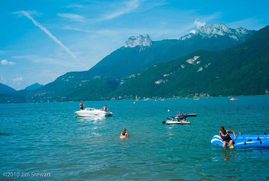
as were the campsites - les Néerlandais aiment aussi les lacs francais, it seems

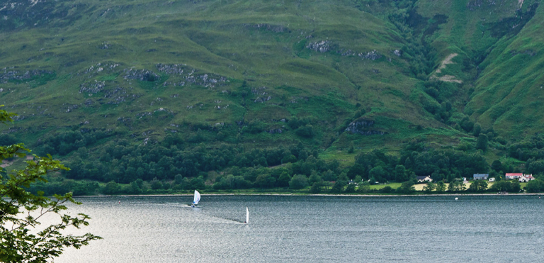
the next shot - cropped from the last - gives some idea of the aerial congestion we saw over Lac d’Annecy
day of the deux Lacs : #1 : Nantua
11/07/10 10:11
we had no real idea what to expect of Nantua
and had not allowed any time to spend there. Just passing through on the way to Lake Annecy. The Rough Guide to France doesn’t even mention Nantua
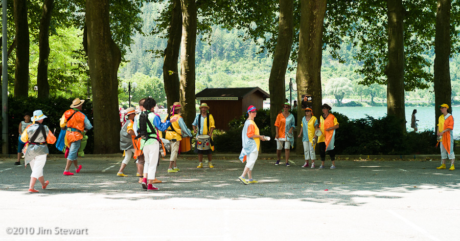
...not its carnival...
... nor even its Lac...
the Lac de Nantua, cradled in its limestone cliffs, 1500 ft above sea level
Nice place. We will return!
And funny books those Rough Guides! More Nantua info here
turn-off to Tournus
10/07/10 10:19
today we set out in increasingly sweltering heat...
...aiming to camp for a night or two in the Jura, while heading in a generally southerly direction towards the Alps of the Haute-Savoie Département and the Lac d’Annecy.
Maybe it was the lack of planning, which meant we didn’t really know where to head for in the Jura, and found ourselves a bit directionless. Or maybe it was the heat, and the clear imminence of a major storm. Probably a bit of both, but at Salins-les-Bains we decided to head west, chickening-out on the possible concatenation of mountains, storms and camping. So we took a steer from the Rough Guide and headed over to the Saône valley and the town of Tournus.
The municipal campsite at Tournus was on the banks of the Saône, but a good way out from the town, and in one of those complexes including the Stade and the Piscine, that don’t always augur well for peace and quite, so we headed back to town and found a Logis, just as the rain and the thunder began.
The following morning we read in the local papers that major storms had indeed caused extensive damage in the Maconnais, not too far south of us, and in the Alps.
Strangely, neither of us took any photographs that day. Would we go back to Tournus? Maybe, but maybe we’d pefer to take a longer look at the nearby town of Louhans, and count its arcades (There’s supposed to be 157 of them)
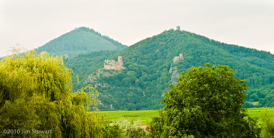
... to Colmar
09/07/10 18:52
castles everywhere. All ruined. Border country, eh!
This shot from Huhnawihr
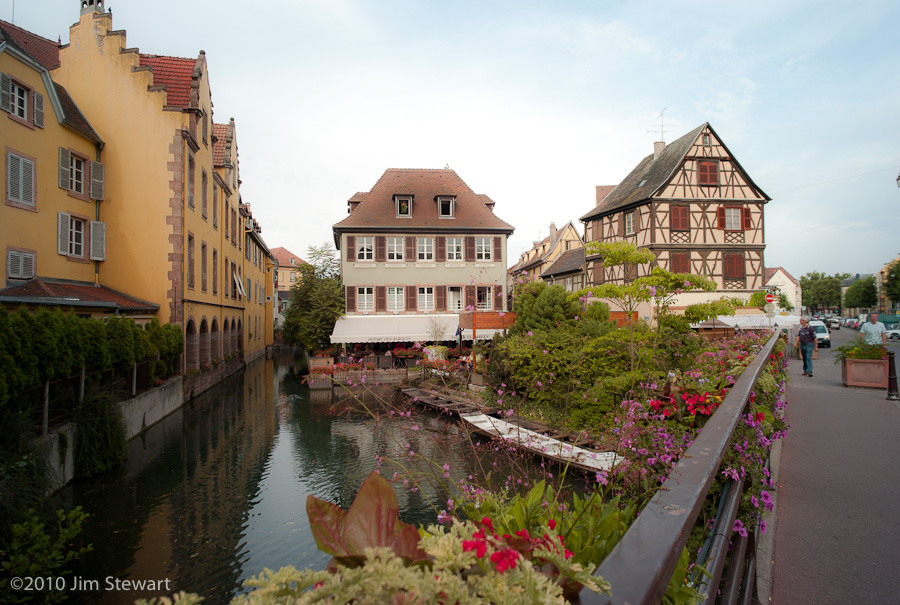
Our jaunt ended in Colmar - a working town, not a tourist-magnet, but well worth a visit, especially to the area styled “La Petite Venise”
and here, at the end of the Route des Vins, were the vins....

...onward down the Route des Vins...
09/07/10 16:58
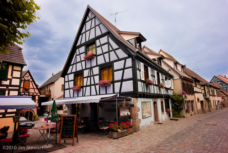
a stork’s nest overlooks the entry to the village of Ribeauvillé

and just a little further along, at the “Centre de Réintroduction des Cigognes et des Loutres” (Centre for the Reintroduction of Storks and Otters) at Hunawihr, storks patrol the car park (we didn’t go in)

We didn’t spend much time at Riquewihr, either. It may be one of the “Plus Beau Villages de France”, but it’s milking its status to the point of being nigh-unvisitable. Here’s a quite corner...

If only it had all been so calm!
morning in Obernai, then out on the Route des Vins
09/07/10 10:07
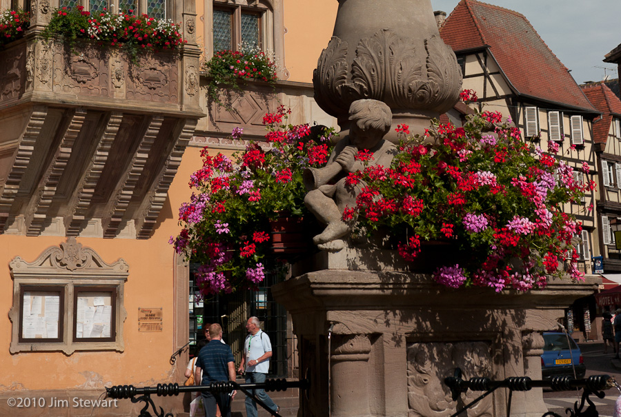
wake up & it’s an Obernai morning & the first thing that we see, over breakfast, is the geraniums in the Place du Marché
They’re almost everywhere else you look too.
This place is barely French, architecturally...
...but perhaps the more intriguing for that Tuetonic touch...
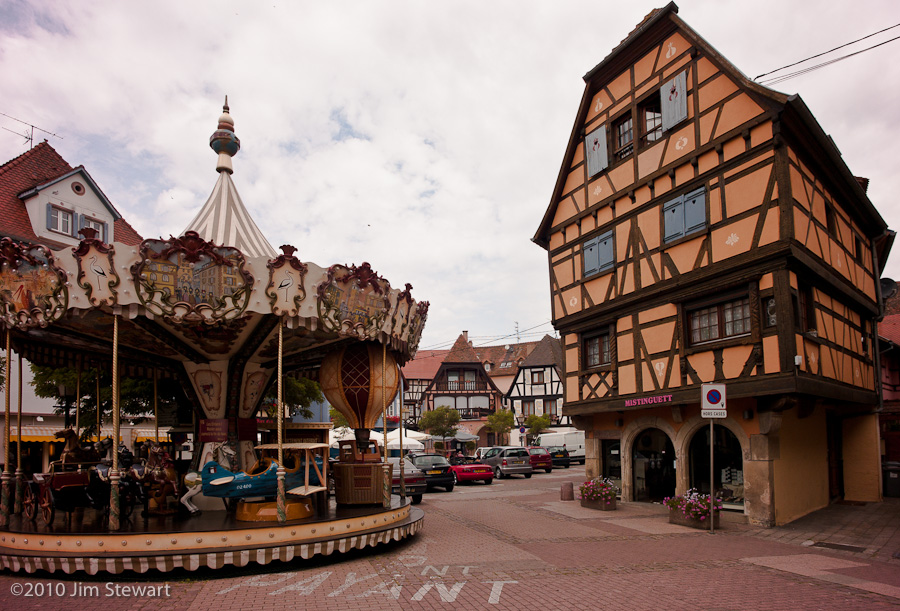
... it feels like the buildings here look eastwards, directly towards Prague, perhaps.
Years ago, driving back up France towards the Channel, a young friend remarked to Jim that northern France is more “French”, while the south is less French, more Mediterranean. In this trip to eastern France we were to find our attention drawn to a less French, more mittel-Europan architecture and ambiance.
Ideas for future trips rush in... but for today, it’s off to explore Alsace, and after a wrong turn up the forest-engulfed Mont Ste. Odile, we’re away on the Route des Vins, to Itterswiller...
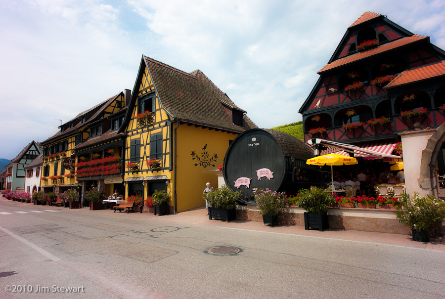
(there’s Ruth checking the menu at the Weinstub - it wasn’t the food, or the prices, but the bus-load of tourists that deterred us from eating here)
and Bergheim...
...altogether a lieu plus sympa, and a good place for lunch...
passage to Obernai
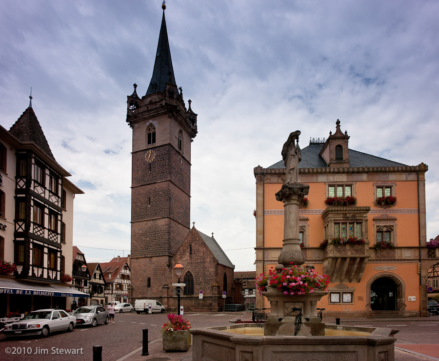
08/07/10 23:04
the second night finds us in Alsace
in the town of Obernai, where we stay for a couple of nights in the Hostellerie de la Diligence. Our room overlooks the Place du Marché
which is worth a couple more shots. I think:
La Diligence is certainly one of the nicest Logis we’ve encountered so far on our “tent and logis” travels
to IJmuiden, thence to Vianden
07/07/10 23:57
sure enough it’s a sunny start to the day when we sail into IJmuiden...
and that sunshine stays with us as we wander south, ending this first day down below the castle

down by the riverside
in the village of Vianden on the river Our on the eastern side of Luxembourg,
heading out
06/07/10 23:27
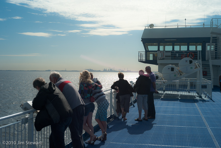
leaving Newcastle-upon-Tyne we’re off out on the North Sea
leaving these grey UK weather tones behind??
more from S.A.
13/05/10 00:47
specifically, two more galleries uploaded in the last 12 hours
These galleries are from our time in Johannesburg.
The first covers our visit to the Constitutional Court - as much an art gallery/ celebration of South Africa’s diversity in creativity as a institutional cornerstone of the freedom and reconciliation process which is central to the political ethos of the transition from apartheid to C21 living in the “beloved country”.
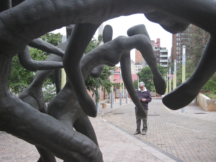 (a rare shot of Jim here...)
The second contains pictures we took driving through the CBD (Central Business District) and on to Newtown and the Market Theatre.
More - many more pics - to follow (though it’s likely to be about 10 or 12 days before the next galleries go up)
at Last: South Africa
11/04/10 14:08
it’s been a while...
... but today witter-n-grunt.com has its first pictures from our South African trip last November online. You can access the first couple of galleries, entitle “Getting There” and “Johannesburg & We’re Off” via the new South Africa Galleries page here.
More will follow in the days and weeks ahead. Honest
going Back...
20/03/10 16:04
.... to summer of 2009, in this instance, to catch up on posting some holiday stuff.
Today we’ve added a new gallery to the Gallery Index page, with a bunch of pics from Jim’s camera taken on the day we woke up in Desenzano and went to bed in Malcesine, in the extreme south west and the far north east, respectively, of the Lago di Garda.
This was an anniversarial expedition: in August 1999 Ruth was staying at the Hôtel du Lac in Malcesine when a trip into Verona led to her and Jim meeting up for the first time.
Ever.
In the bar of the Hotel Antica Porta Leona, just down the street from Guilietta Capuleti’s old gaff. Tutto troppo romantico!!
So ten years later we were back. From Lake Garda we went on to Verona, then down to Levanto and the Cinque Terre in Liguria.
More will follow. Check back soon...
suddenly last summer...
28/12/09 00:09
When we got the Pannetts' Christmas Epistle this year, we were struck - no, haunted -
by the closing allusion to a mysterious photographer they'd seen taking pictures of swans on Lake garda.
Somehow struck a bell, but could we place it?
So nothing for it but to rummage back through the pics from our Gardese sojourn in August. And guess what!?!
There he was, in the little square by the Porto Vecchio in Malcesine...
...and, again on the pier where the boats come into Malcesine, ...
And. stranger yet and stranger,who was that shadowy figure lurking in the by the alleyway by the little pizzeria where we ate pizzas (duh!) and drank Allegrini's finest La Grolla just off the Piazza Bra in Verona, on the eve of the 10th anniversario of our primo incontro on 12th of August 1999??
I think we maybe need to go somewhere more discreet in 2010. Like Gurndsey, or Mancunia or some such place...
glasgow
04/11/09 23:02
here we are in Glasgow (or quite nearby). Overnighting in the Holiday Inn at the airport
Tomorrow we fly to Johannesburg, where we’ll arrive the following day. Tomorrow night it’s Dubai Airport for 4 hours between planes.
Fun.
Here’s a shot of Rannoch Moor this morning. Taken from the coach
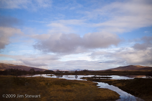
Good what you can see on a bus pass, heh!
Milano (2) : The Art Factory
29/09/09 20:13
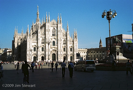
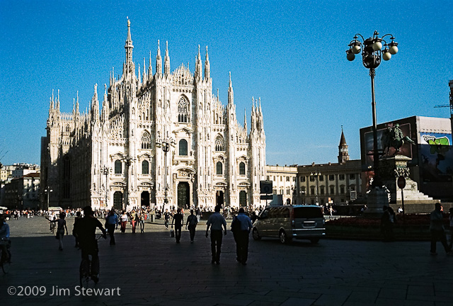
Milano : La Piazza del Duomo and the Roof of the Duomo
29/09/09 19:33
Milan's cathedral is unlike any other Italian cathedral we've ever come across. It has over a thousand statues on the exterior of its roof alone.
Every point of this vast gothic edifice is extruded to produce a pinnacle which serves as the plinth for a sculpture of a saint
Click HERE to view a slideshow of pictures Jim shot on film using his Voigtländer Bessa R rangefinder camera in the piazza and on the roof.
Interesting to work on film again, and to rediscover the gotchas of celluloid. On this occasion it was the 24-shot film. Ran out half -way round the roof.. Ho hum. Thought it was a 36. Gotcha!
sailing up Lake Garda
08/08/09 23:43
return to the stacks
01/07/09 00:22
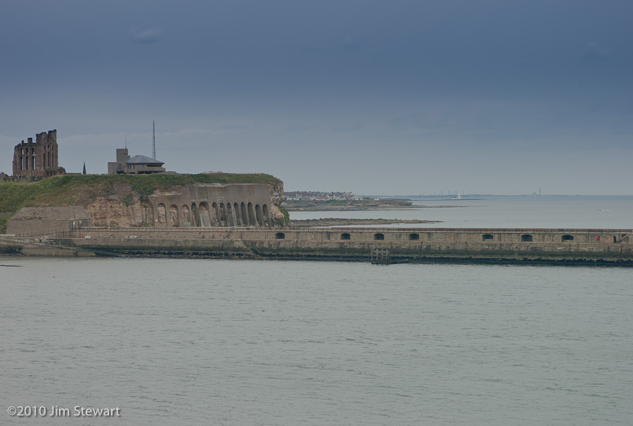
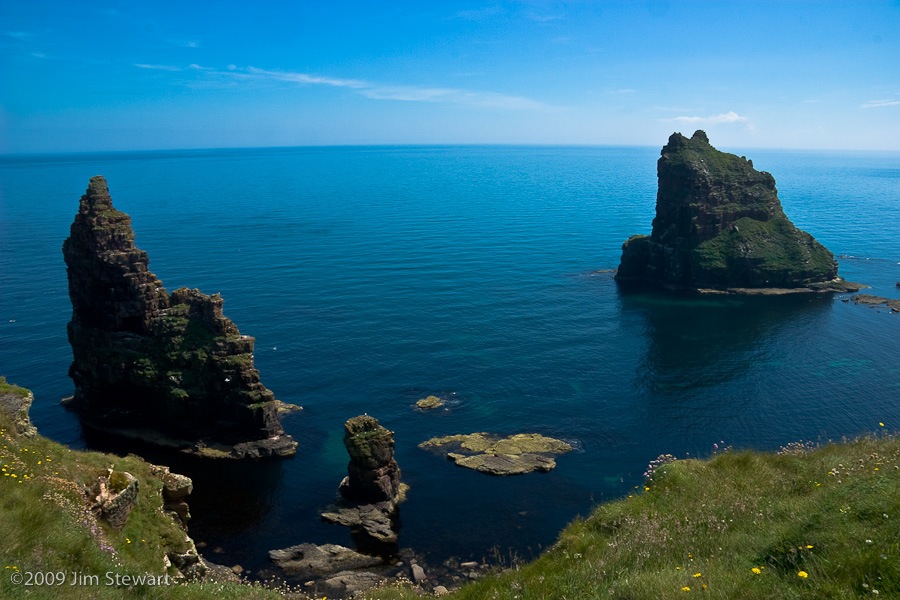
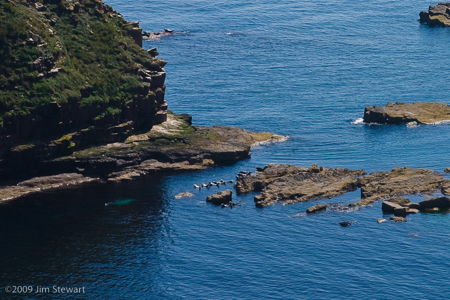
so that meant no alternative. Next day was back to Duncansby Head...
this time to get across to take a look at the Duncansby Stacks. Wonderful, extraordinary stone pyramids carved by the sea from the sandstone cliffs at this point at the NE tip of mainland Scotland, mainland U.K.
Interesting enough as geomorphs...
...they also "harbour" some interesting wildlife, such as the seals' taxi-rank you'll see in this shot
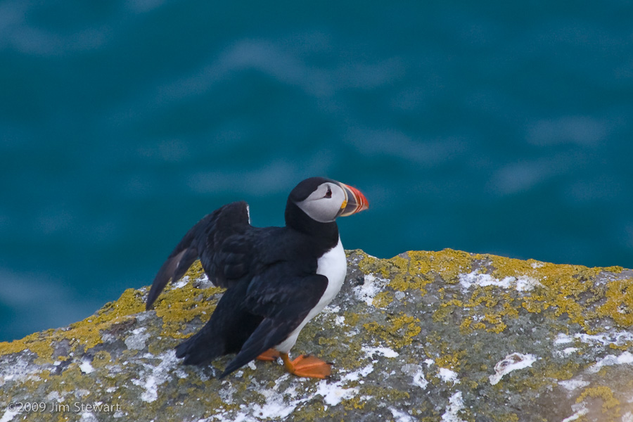
the great puffin hunt...
30/06/09 20:34
...takes us back to the Far North
This time we stay a week in Thurso, and take a couple of trips out to Duncansby Head. Famed from the shipping forecasts, this is the far north east corner of the Scottish (and thus the British) mainland. The coastline is characterised by its cliffs, and by the stacks which the sea has carved from the sandstone. The deep inlets in the cliffs are home to massive numbers of sea birds, as are the stacks.
And the "stars" hereabouts are the puffins.
Conversation between passing strangers along the cliff-top paths concerns not the geological spleandour of the stacks - nor the diversity of the ornothology thereabouts. Instead it consists largely of variants on the Q&A: "have you seen any puffins?" and "there's puffins over there, and there, and there; or there were yesterday/ last week/ whenever..."
Here's one:
We'll post more - and more diversity - in the next few days. Check back...
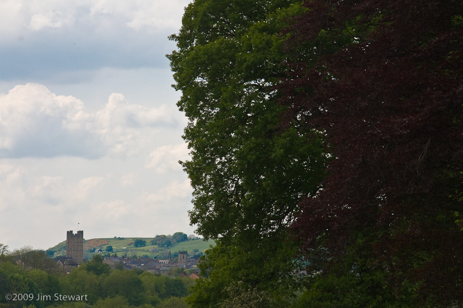
... and then to Richmond, Richmondshire ...
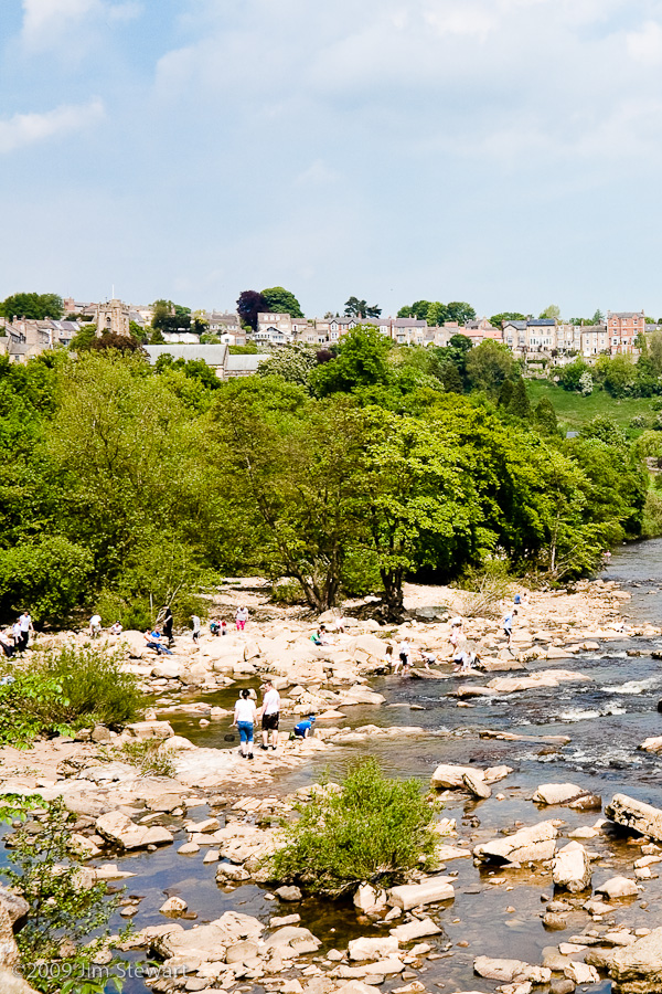
27/05/09 23:53
...where the River Swale swirls below the rather impressive medieval fortifications of what may be Yorkshire's "Best Kept Secret", Canadian cousins and pro tem ex-pats John and Barbara invited us to stay on our way back north
Richmond is a peaceful spot, most likely, when its not the annual Richmond Meet. The Meet is not a quiet event
Starting back in the years of industrial gloominescence, at the time of the formation of the Harriers clubs and the prototypical Ramblers - among the most lastingly successful of socialist/ communist initiatives in the UK - cyclists' groups from Yorkshire and the industrial North East converged on Richmond at the May Bank Holiday, when the Swale is warm enough to paddle in, and to cool the overheated cyclist from Halifax or Jarrow. Those who moan of lycra-louts today should not forget the past of cycling and its place in labour history
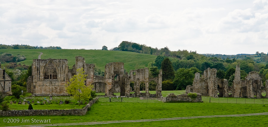
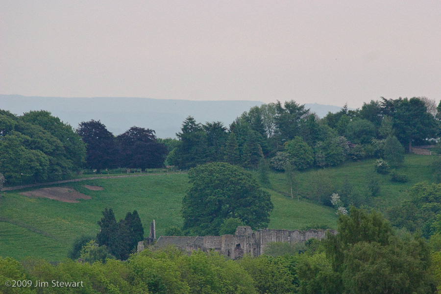
Nearby Easby with its ruined abbey and remarkably unsacked church was a more tranquil terminus ad quem for a holiday Monday walk. The light wasn't outstanding, as a storm was brewing mid-afternoon that broke in te early evening, but these pics give some idea:

under-rated H8 mash-up monasterio, just a very pleasant stroll from the town ...
... as this telephoto shows (least I think that's Richmond Castle, taken from same place approx. as the last shot of the Abbey, with approx. 90º turn to right)
And this, by way of reflection on the walk, is Easby from the window John & Barbara's top floor flat in Richmond
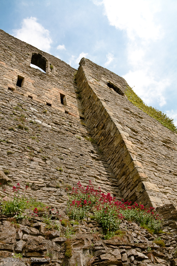
We liked Richmond. With the flower-bedecked castle ...
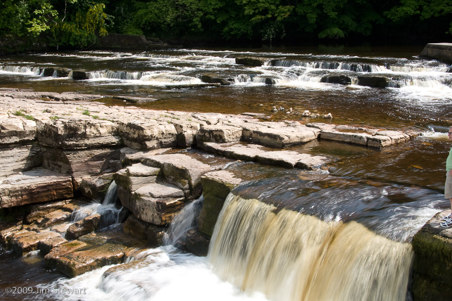
... the rapids ...
and its topological charms

So thanks! John & Barbara, for putting us up.
We're sorry we didn't have longer to explore, but we do look forward to returning the favour sometime soon, up here 'n'a'heelans
to wendy world...
24/05/09 23:51
... where, at Cocked Hat, Dave and Wendy
made us welcome on the Sunday afternoon, asthe reunion reunited...
Oh and Ralph....

The climax of the day was either the superb repast of Yorkshire pork with roast spuds, cheesy leeks and all sorts of other goodies - even the veggie option looked enticing, though we didn't get our hands on any - or else it was the walk in the woods, with adults, children, a horse, three (four?) dogs and a mog.
Jim took lots of pics along the way, and they make up most of what's on display here - check it out. And if anyone's got any pics of stuff they think we've overlooked, then please do email them to Jim and he'll add them to the appropriate collection
to ripon...
23/05/09 23:23
... for a meet with folks we seldom see

In fact, it usually takes a funeral to get this lot together. But now Jim's the oldest survivor this side of the Atlantic. Duh!!
Chez Jill and Vic at Low Lindrick - a spot unknown to local taxi men - we passed a pleasant afternoon renewing old acquaintance and forging new.
The sunshine battled against and intermittently overcame the cold Yorkshire wind. But a wow! of an event it was, and all thanks - we should prolly say kudos in the blogging context - to Jill and Vic for their welcome, hospitality and massive array of nosh! Safe to say we were all well fed up and agreeably drunk...
Click here to view a first gallery of pics - more to come, probably tomorrow
a damp, but lively, start to the day
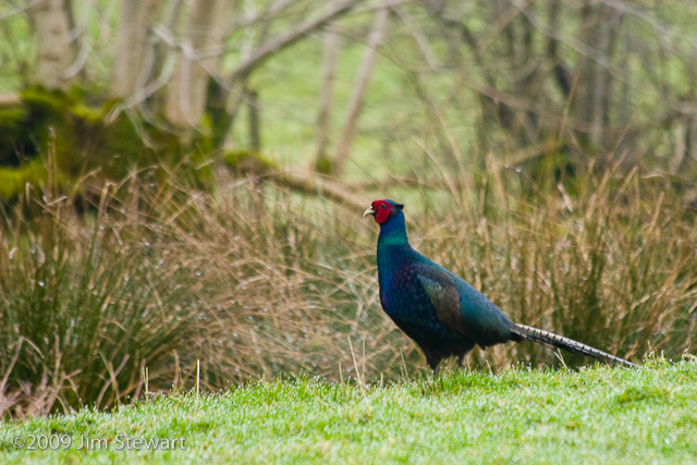
01/04/09 15:54
with dewdrops on the grass, and pheasants - all misty wet with rain -
in extraordinary colours, patrolling the field outside our windows. And...
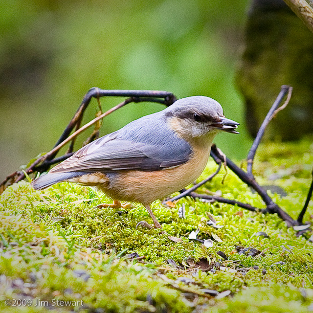
...a woodpecker (Greater, and Spotted, no less) on the feeder outside the kitchen window...
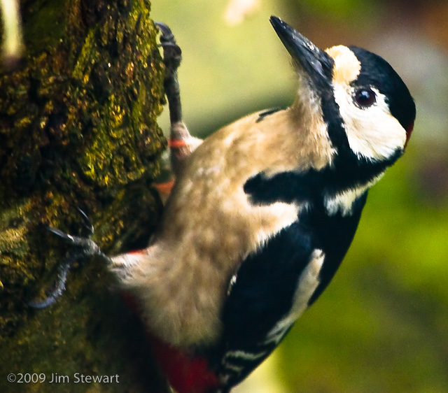
... as dapper a chaffer as you could hope to meet...

...when he could squeeze the nuthatch out the way....
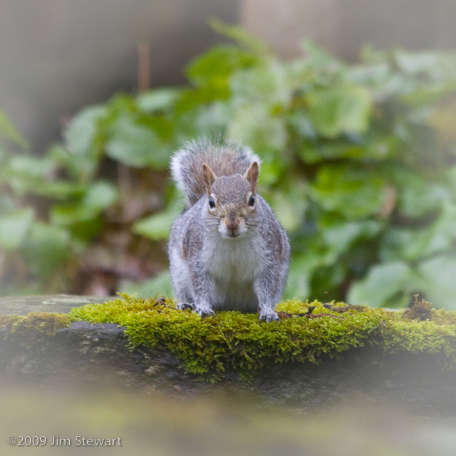
...squirrel permitting, of course...
And of course, being Yorkshire, soon as the sun comes out, there's these, everywhere
Just love that pheasant, though. Here he is again...
if it's spring, it must be yorkshire....
29/03/09 13:55
.... or somewhere therabouts.
Somewhere just inside of or just outside of the past or present, or who knows even future, County, Shire, Riding, Thryding, Wapentake, administrative district, area of outstanding this or that, national park or whatever that is was or shall be Yorks.
Any road up, as March turns towards April we're off in the direction of the Howgill Fells

This time we're staying at Killington, in Ghyll Stile Mill Cottage (left of pic)
near Sedbergh (that's Sedbergh - pronounced Sed-burgh by some, Sed-berg, by others, but Sedberr or Sebberr by those in the know - the local residents.
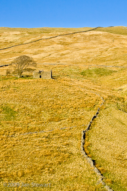
This puts us in Cumbria, South Lakes District Council turf, but just inside the Yorkshire Dales National Park.
Maybe it's the limestone, or the way the hillsides are speckled with crumbling stone field barns, but when the sun shines on the landscapes in this part of England, it's extraordinarily reminiscent of France. Those field barns must have been built to serve much the same purposes as the "bories" which litter the fields and hillsides of France from the Dordogne to the Auvergne and the Aveyron - even on the stark and uninhabitable "causses" uplands of the south.